By Caleb Cass, Vice President of Engineering
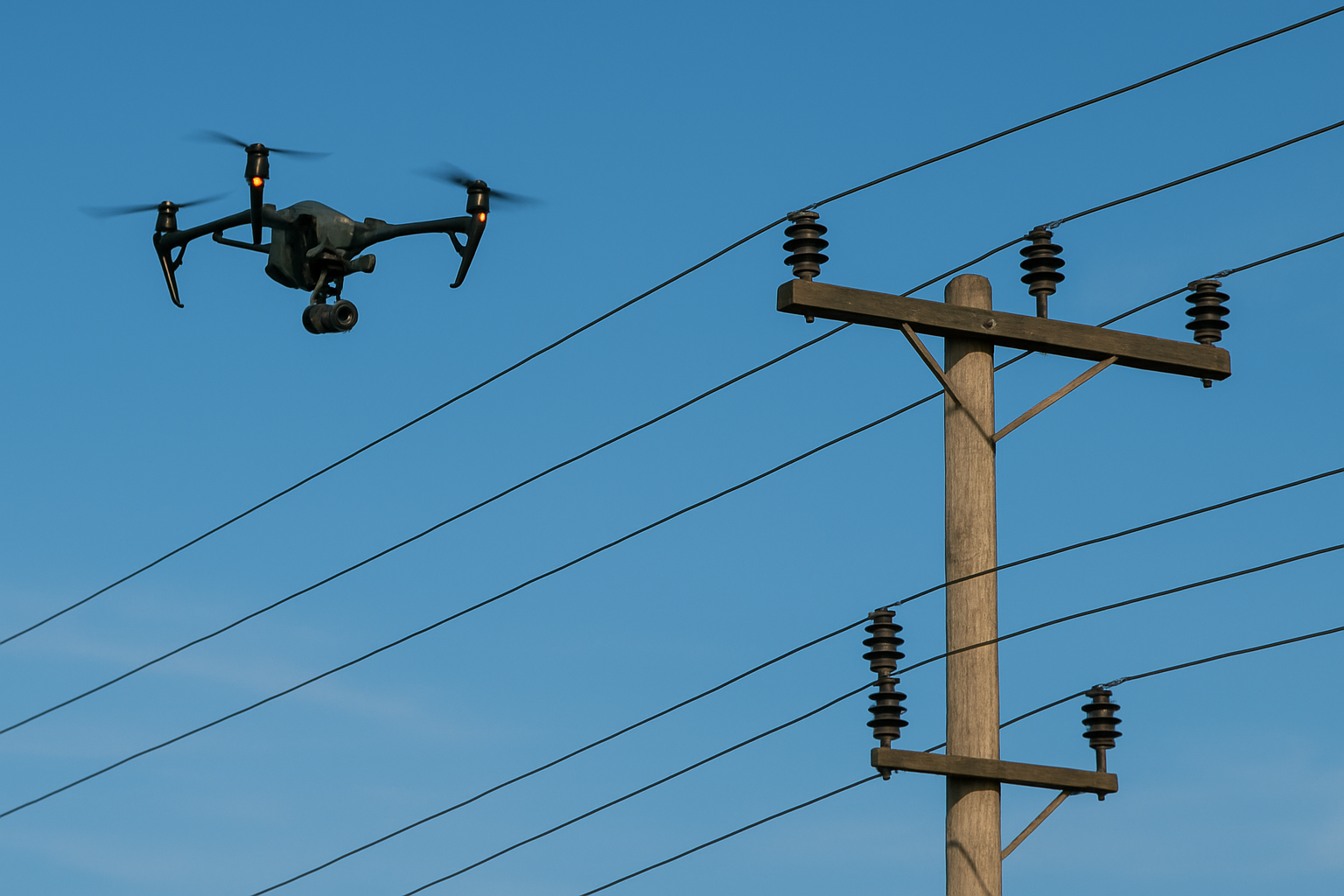
In this case study, we provide an in-depth explanation of a ground topography scanning project using GeoCue’s True View 410 3D imaging system (3DIS). The True View 410 comprises a Quanergy M8 Ultra 8 beam laser scanner and dual GeoCue Mapping Cameras.
Problem
A Firmatek client who operates large rock quarries throughout the United States requested that ground topography be captured of approximately 2,000 acres at one of their sites. The client required a scan of the entire area to assess undeveloped heavily vegetated areas to expand their mining operation, build roads road and erect buildings. This data would be used by us (Firmatek) to calculate the change in volume of different materials and work areas, such as stripping, mining, caprock and overburden dump piles. The primary goal of the field work was to capture topographic ground data only, but the inclusion of aerial orthophotos of the areas would be valuable to the client and could be charged as an add-on deliverable.
One of the biggest challenges of this project was the sheer size of the area that needed to be covered, combined with the fact that the area included a rock quarry as well as undeveloped land. The rock quarry itself consists almost entirely of bare, exposed earth. Without the presence of vegetation or water in the areas of interest, a professional grade photogrammetry drone is a great tool for data capture in this type of environment. But the undeveloped land in this case was covered with thick ground vegetation in some areas and fairly dense tree cover in others. In these types of areas, a photogrammetry drone is either unable to detect clear ground points or cannot find adequate matching point pairs to generate accurate ground data. The result is usually a “blanket” of data that sits right at the top of the grass or right on top of the tree canopy. In this case we needed to be able to capture accurate ground data over a large area that included both bare earth and heavily vegetated areas.
Approach
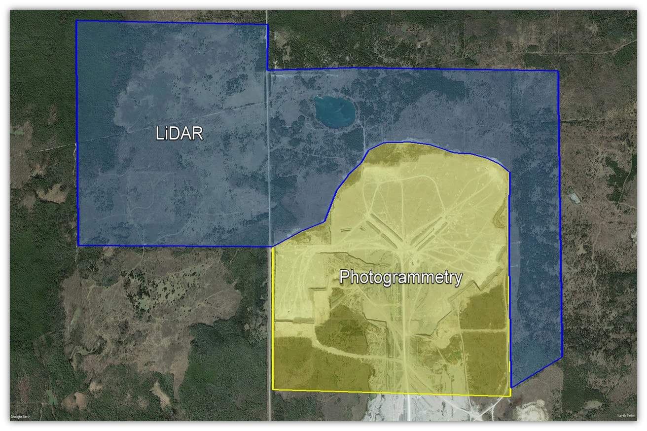
Our approach was to use multiple UAVs with different types of sensors to cover the large area efficiently while also capturing accurate ground points. This division was based on using the sensor most appropriate to the terrain type (see Figure 1). This would require multiple flight teams to be on site and operating at the same time, which would require very close coordination and constant communication between the pilots and their support teams.

Above: (Figure 1) Project division.
The benefit was that the fieldwork could be completed much more efficiently compared to sending one crew who would have to start with one system before switching platforms to capture the remaining areas. As a result, the time required to collect the data in the field was cut in half with less drone equipment. The plan included capturing an early “before snapshot” of the area to establish a baseline dataset that would be used for a variety of business needs including development proposals, obtaining building permits, ongoing volumetric and cut & fill calculations. GeoCue’s EVO software efficiently merged both LiDAR and photogrammetric datasets, captured simultaneously, into one continuous digital terrain model that would be used for volumetrics and topographic data generation
Solution
Our UAV platform of choice was a fixed-wing photogrammetry drone equipped with RTK and PPK capability to cover the exposed areas, along with the True View® 410 combined with LIDAR and a photogrammetry platform from GeoCue Group Inc. (GeoCue). The True View 410 would be used to capture data in areas with heavy vegetation and/or tree canopy cover. One of the greatest benefits of GeoCue’s True View system is that it is equipped with both Quanergy’s M8 Ultra LiDAR sensor and dual photogrammetric quality cameras, giving it the ability to simultaneously collect vegetation-penetrating data as well as photos for aerial orthomosaics during the same flights.
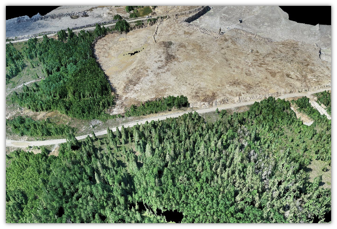
Above: High quality aerial orthomosaics produced by the TV410.
A fixed-wing RTK photogrammetry drone was used to cover all areas of exposed bare earth within the rock quarry and the surrounding area. The fixed-wing drone is very efficient and effective in these types of environments, where there is not thick vegetation or heavy tree cover.
Results
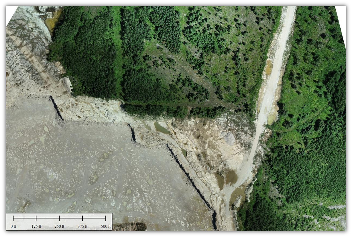
To be able to compare results from the two systems, a large area of overlapping data was captured by both platforms. The point cloud datasets were then checked for geolocation accuracy by comparing them to known checkpoints within the flight areas and by comparing them to each other for overall scale and dimension. Both systems performed well for their intended tasks. The LiDAR data set allowed us to eliminate tree canopies and penetrate vegetation to acquire points that were closer to true bare earth.
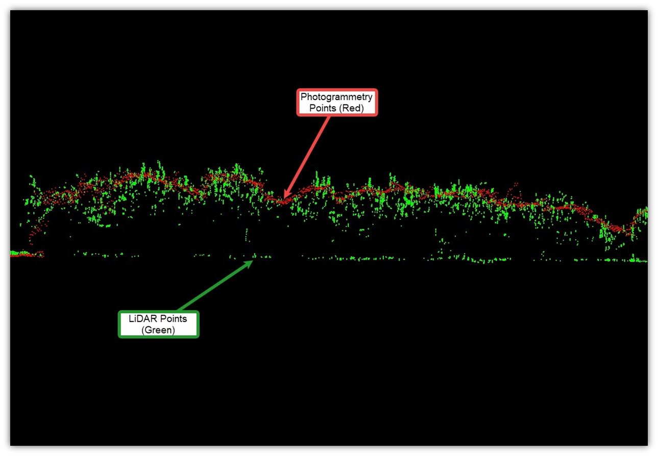
Above:Combined point cloud data sets comparing vegetation and bare earth used to create terrain model.
The two data sets were merged into one continuous point cloud that was used to generate a digital terrain model of the quarry and surrounding undisturbed areas. This terrain model was then used to perform volumetric cut and fill calculations and to generate topographic CAD files for the client’s use in their own mine planning and design software. The baseline data serves as the ultimate point of reference for all subsequent scans and measurements, accurately depicting what has changed on the site for years to come.
The design of the True View 3D Imaging Systems considers camera integration a primary element of the system. Unlike other systems where a camera is typically an optional bolt-on after the fact, the dual photogrammetric cameras of the True View 3DIS are designed in. The fact that we were also able to deliver aerial orthomosaics for the entire area of interest, even though half of the flights were LIDAR, was a huge benefit to our client and a differentiator for Firmatek.
Conclusion
Firmatek was pleased to partner with GeoCue and found that the True View 410 3D Imaging System was an exemplary choice for this project. GeoCue performs a large number of test flights when calibrating and testing their system. However, it is real work applications such as this mapping project that prove the system’s reliability. Firmatek’s constant use of the dual sensing capabilities of the True View 410 (both LIDAR and photogrammetric cameras) validates the value of having these two groups of sensors jointly calibrated.
 About Caleb Cass
Caleb is a civil engineer located in San Antonio, Texas. He works with clients nationwide and manages projects throughout the country. He started his career as a field inspector for one of the ten largest construction contractors in the U.S. and then went on to spend five years performing engineering design for a national consulting firm. Caleb has spent the last ten years at Firmatek performing engineering, mapping, and consulting work primarily for mining, solid waste and engineering clients.
Caleb graduated in 2007 from the University of Texas at El Paso with a Bachelor of Science Degree in Civil Engineering and became a licensed Professional Engineer in Texas in 2012. Connect with Caleb.