
Providing a DYI Solution for Accurate Volumetric Calculations and Enhanced Business Planning
Firmatek equipped a paper mill client with the ability to capture more frequent data, improve the accuracy of volumet...
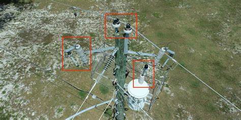
Increasing Electric Utility Survey Capacity to Prevent Wildfires
Firmatek’s ability to offer a faster, safer and more accurate inspection solution for a fraction of the cost helped...

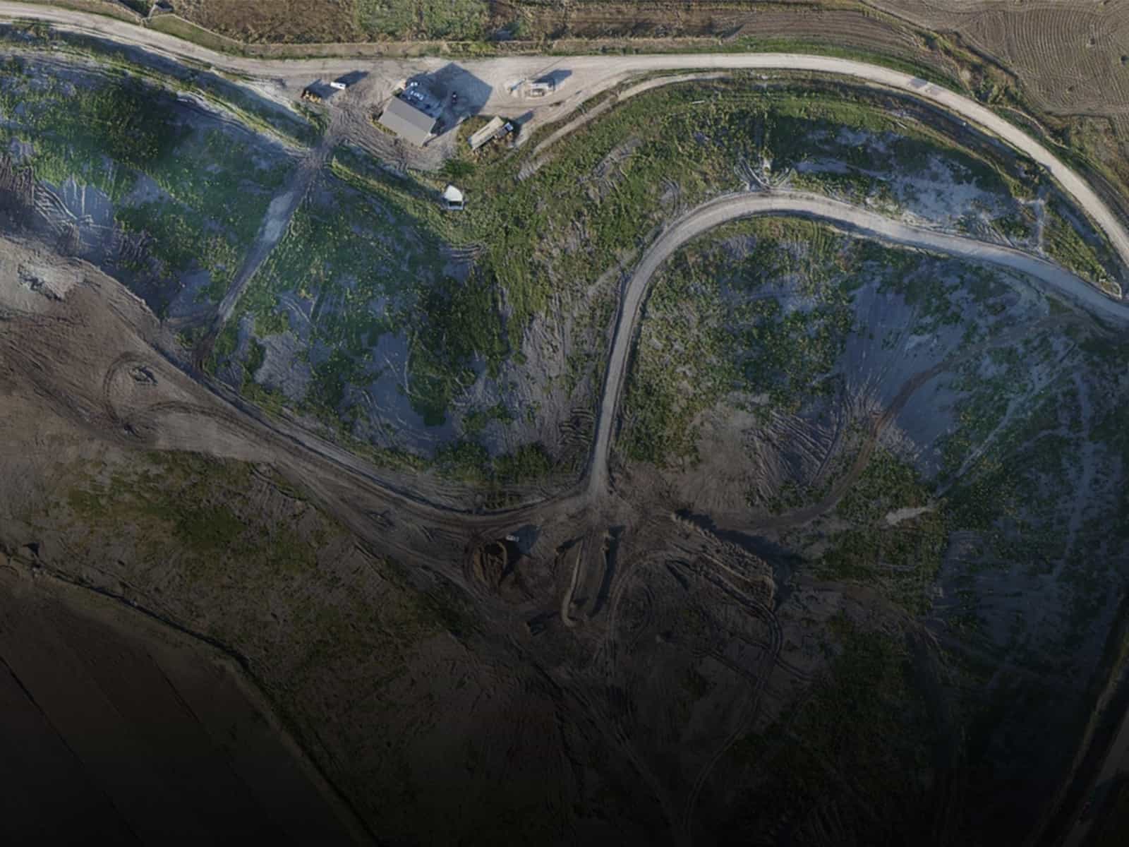
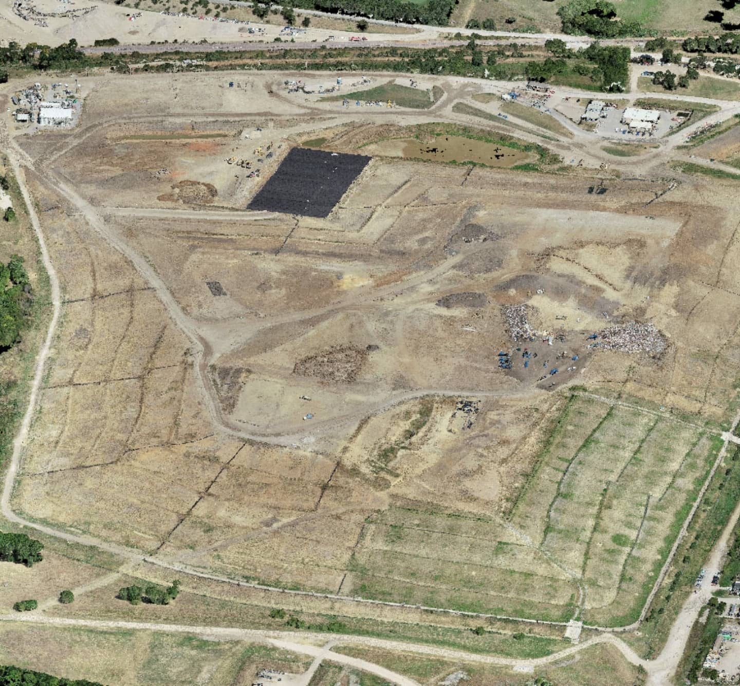
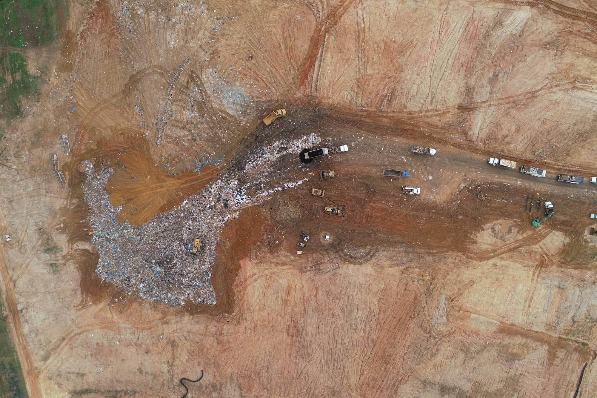
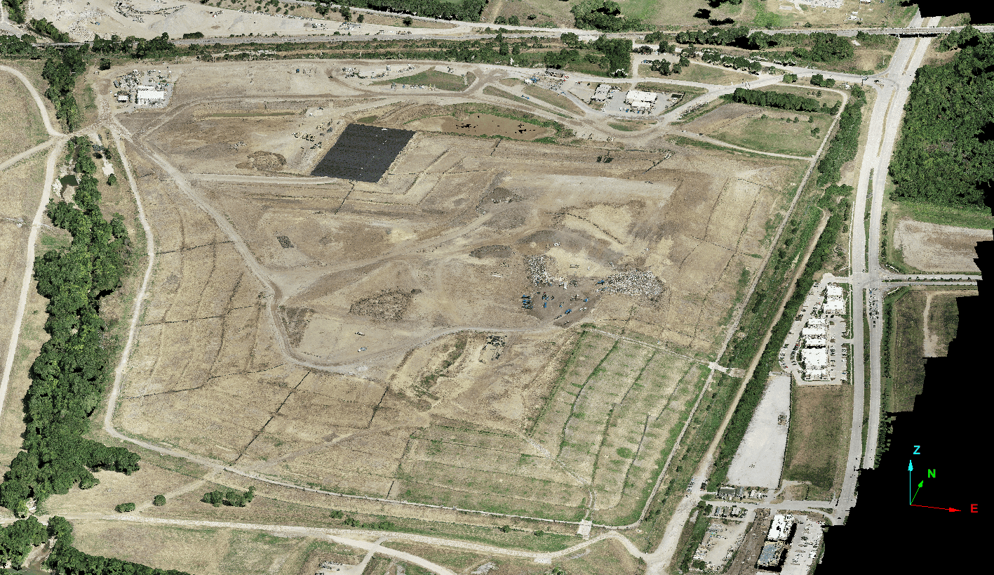
Increasing Landfill Measurements to Avoid Costly Mistakes
Leveraging regular, aerial drone landfill surveys provides timely compaction and airspace measurements, helping teams...
Landfill & Waste Management
Firmatek’s blend of nationally provided services and industry-leading software enables more frequent data capture, aggregation, and real-time analysis to improve site management, compliance, and profitability.
Take control of site management, compliance & profitability
Geospatial data is imperative to your business – from day-to-day environmental compliance to long-term planning. That’s why it’s critical to frequently and accurately measure density, compaction, remaining airspace and methane emissions to increase efficiency, act in good faith, and protect your bottom line. Firmatek’s ability to mobilize quickly and capture aerial data anywhere in the nation makes us the go-to service provider for over 30% of U.S. landfills. Combine that with industry leading software that aggregates data and delivers near real-time insights, and decision makers have the information they need to make the right call from anywhere.

Gain confidence with better data & tailored solutions
We start every relationship by listening to challenges and unique dynamics, then we help solve them with tailored solutions. Through a blend of nationally provided services and leading-edge technology, it’s our goal to simplify complex decisions.
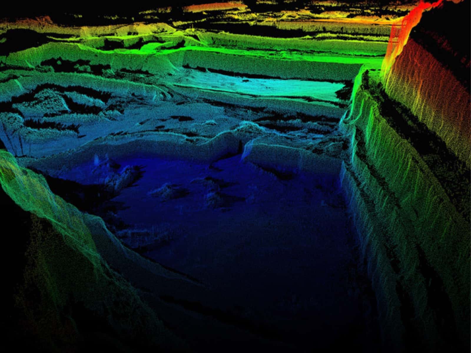
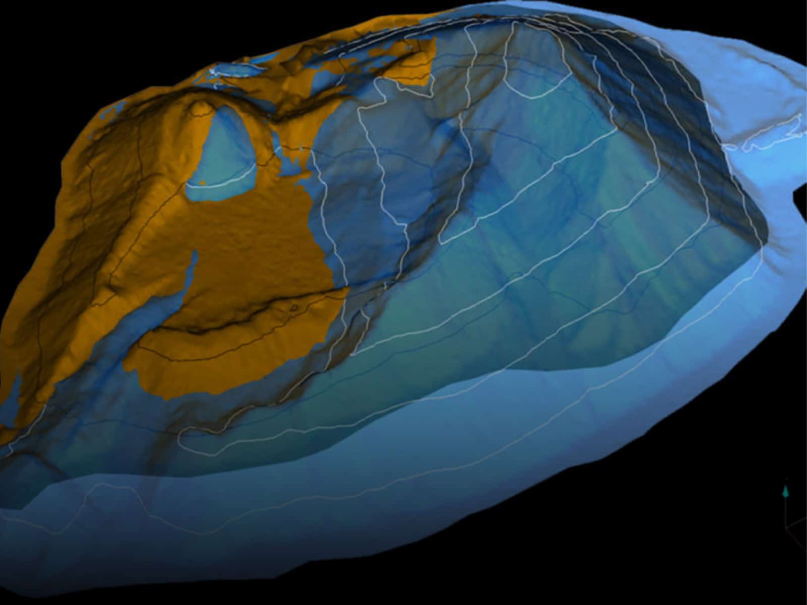
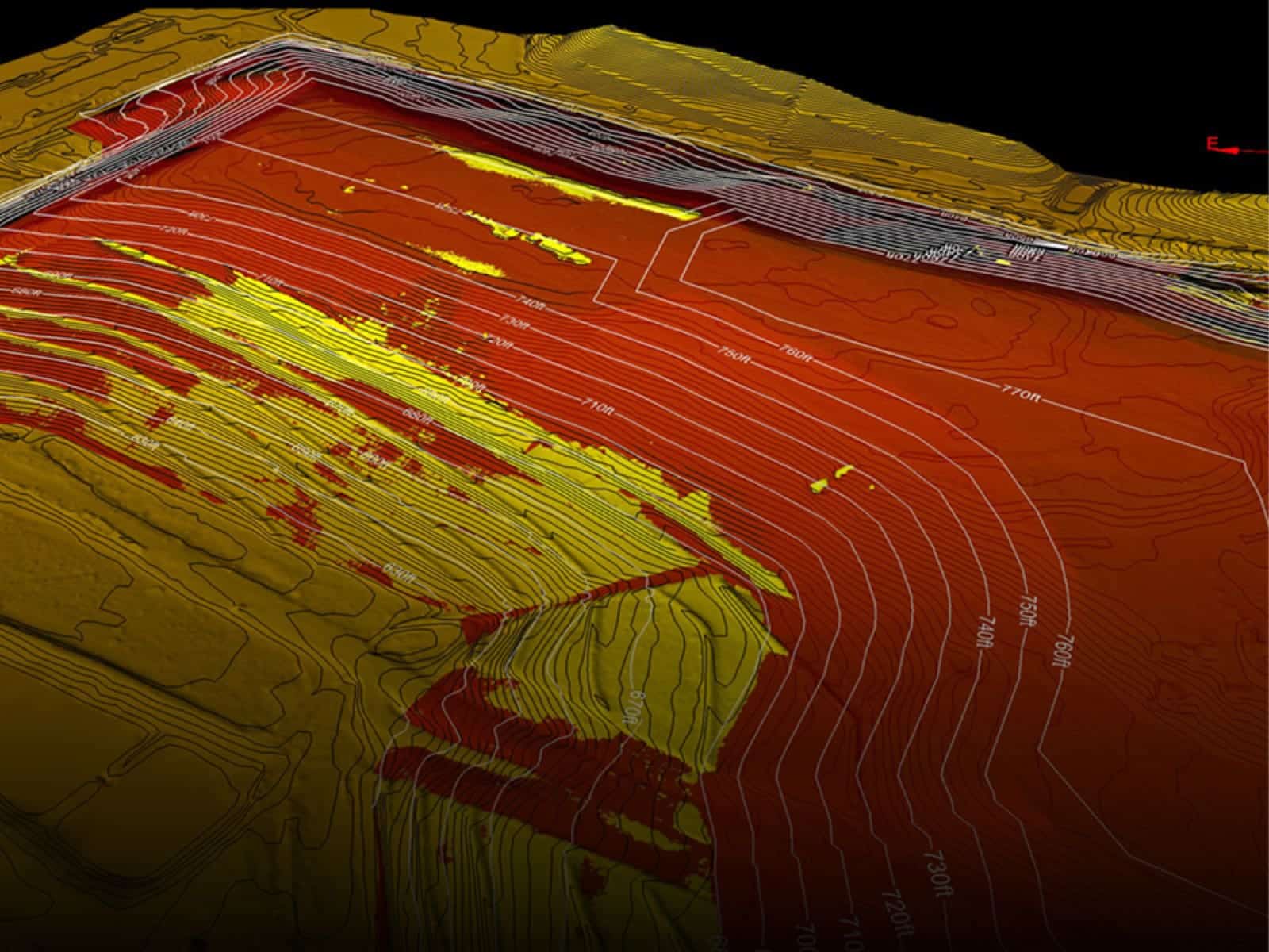
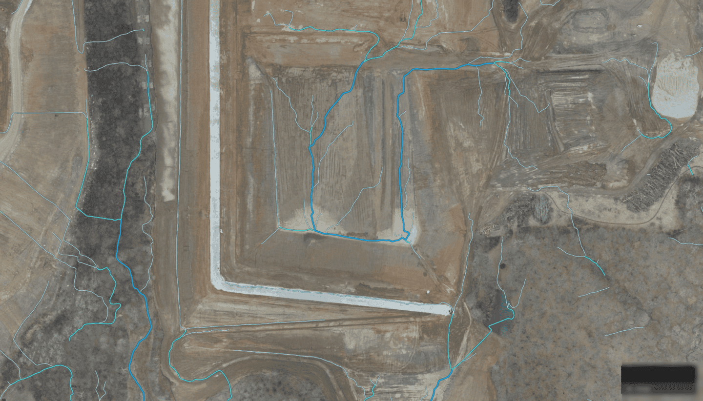
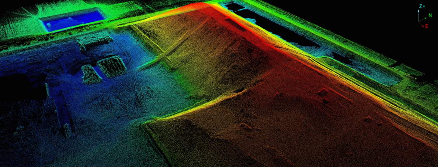
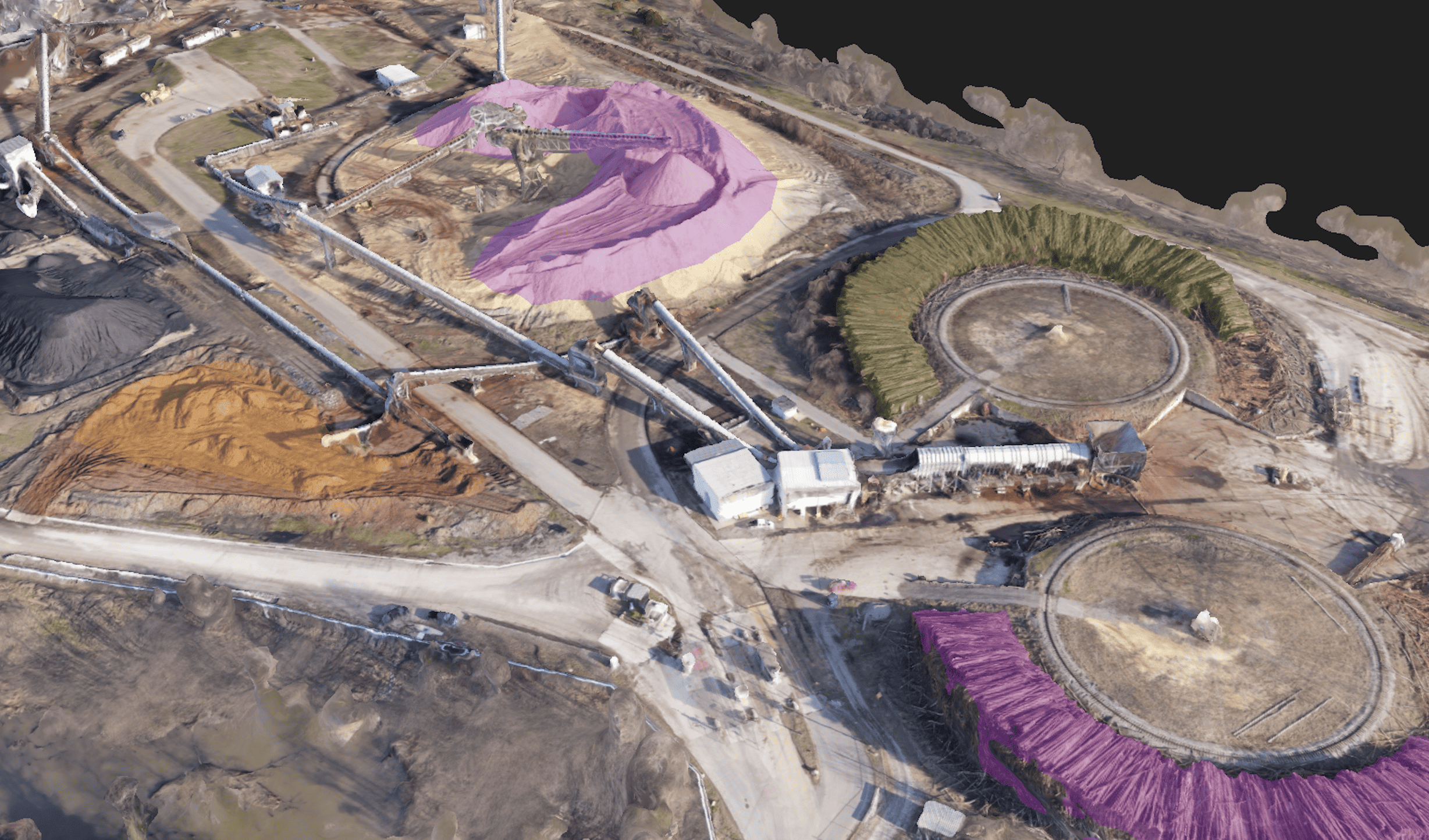
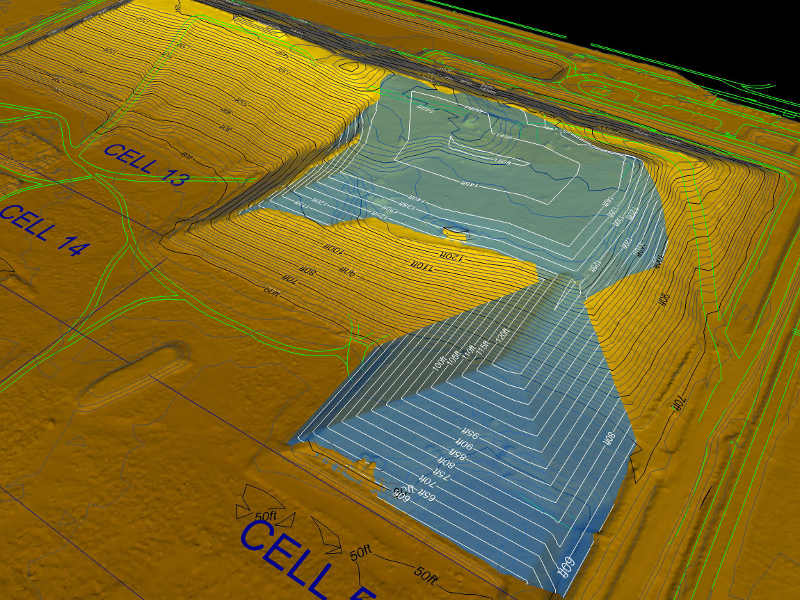
In addition to fill volumes and airspace management, our services include isopach map creation, overfill monitoring, and final cap modeling over topographic surveys. Our engineering team is proficient at integrating data from various sources into a common format that can be utilized by 3rd party consultants, surveyors, and designers. We can scan your entire site and create detailed real-time topographic maps and digital elevation models to help you better envision your site’s existing conditions.
Improve environmental compliance through real-time monitoring
Firmatek helps landfill and waste management partners leverage technology to understand potential environmental compliance issues and accelerate remediation strategies. Efficiency and profitability is directly affected by measurement and compliance, that’s why we strive to democratize geospatial data and equip decision makers with the information they need to improve operations.
Landfill Mapping Services

Calculations & Monitoring
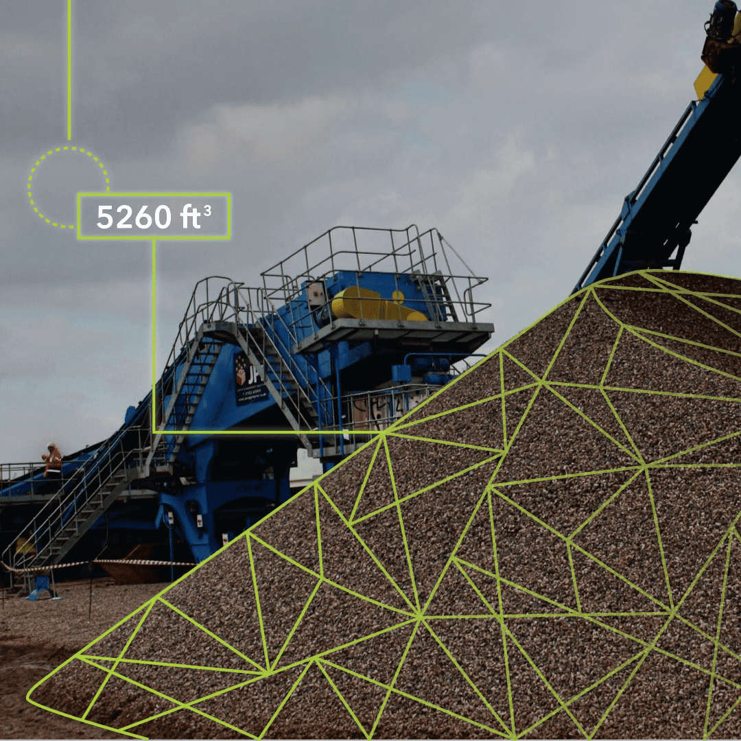
Fill Volumes: We calculate the volume of material moved between scans.
Operational Density: Landfills that regularly measure their compaction density calculations tend to increase them over time.
Constructed Remaining Airspace: We can use intermediate waste grades to calculate constructed remaining airspace.

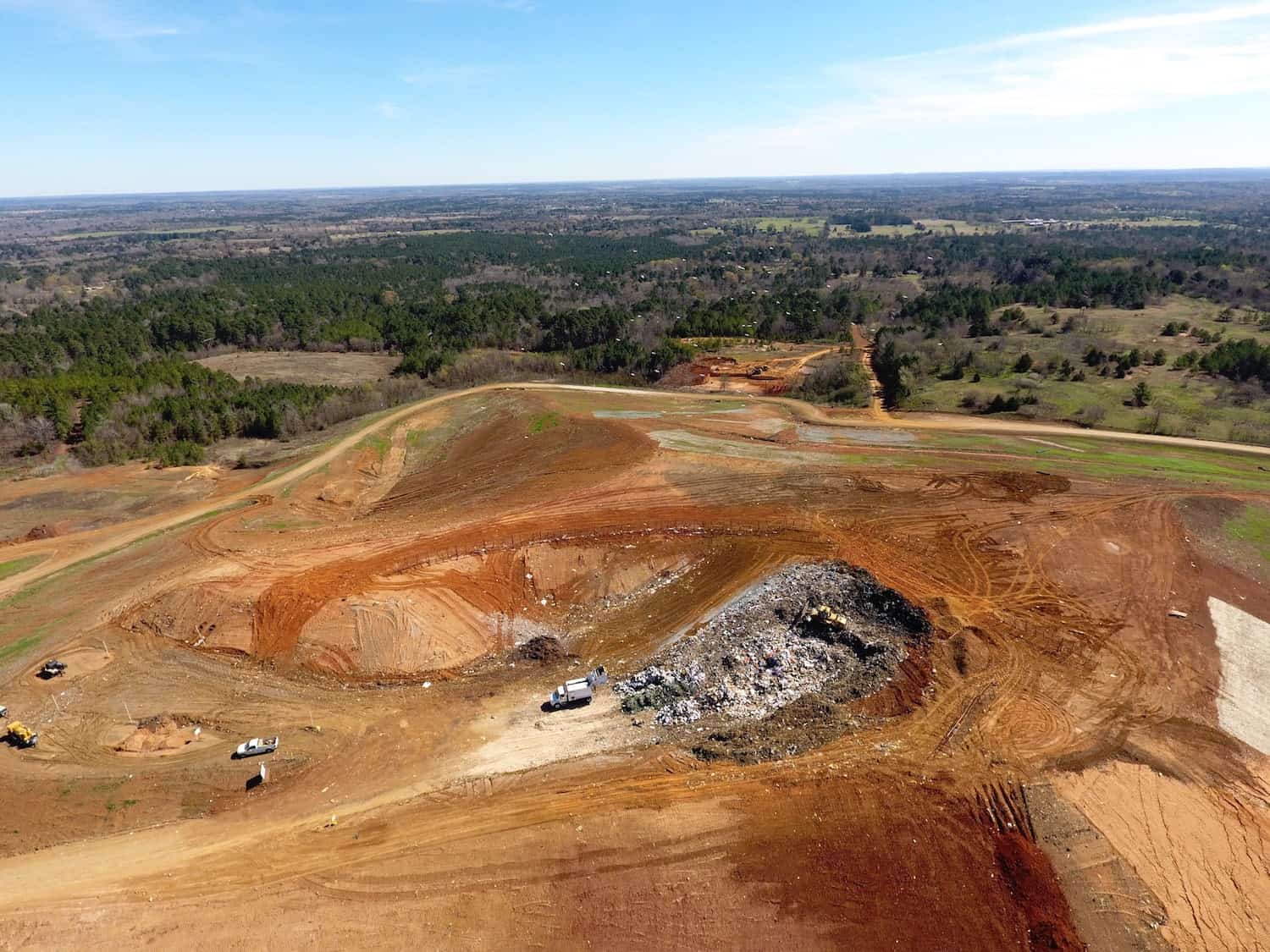
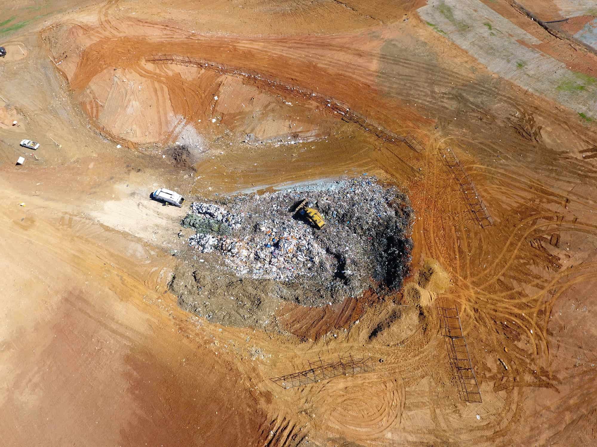
Hazardous Sites
No Contact with Dangerous Materials: Drones and terrestrial lasers allow us to capture data without coming into contact with dangerous materials or walking on active areas.No Site Walking: Our data collection tools allow us to avoid contact between our field team and any heavy equipment operating in the area.

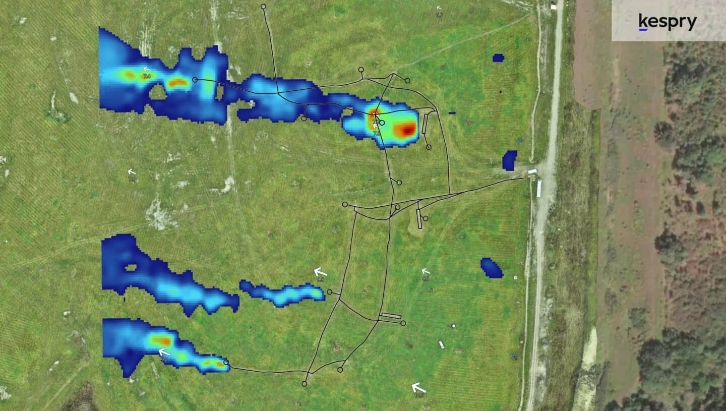
Methane Leak Detection
Detect: Pinpoint methane emissions precisely and address leaks effectively using data collected from a UAV-mounted TDLAS methane detector. This data is subsequently utilized to generate a concentration map, highlighting regions with heightened CH4 levels. Visualize: Engage with methane data seamlessly on Kespry, utilizing specialized tools to display concentration levels, wind vector maps, cross-sectional views, GCCS CAD overlays, and customizable color-coded concentration maps. Easily switch between methane detection missions to evaluate project advancement.Benefits of Firmatek Landfill Solutions
Time Saving
Our team delivers our analysis and results within 5 business days.Operating Efficiency
More frequent and accurate data on density, compaction and remaining airspace to increase efficiency and profitability.
Long Term Tracking
Utilize Kespry Cloud to access dashboards that track and report site-level metrics over time.
Deliverables
Firmatek specializes in 3D point clouds, orthomosaic imagery, LAS point clouds, cut/fill calculations, stockpile volumetrics, and digital elevation models and contours.