
Providing a DYI Solution for Accurate Volumetric Calculations and Enhanced Business Planning
Firmatek equipped a paper mill client with the ability to capture more frequent data, improve the accuracy of volumet...
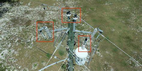
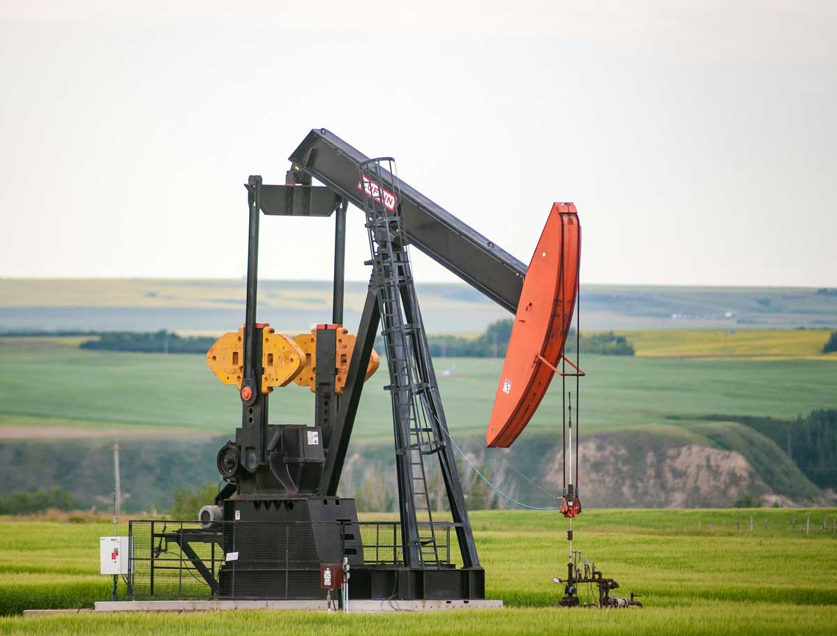
Increasing Electric Utility Survey Capacity to Prevent Wildfires
Firmatek’s ability to offer a faster, safer and more accurate inspection solution for a fraction of the cost helped...
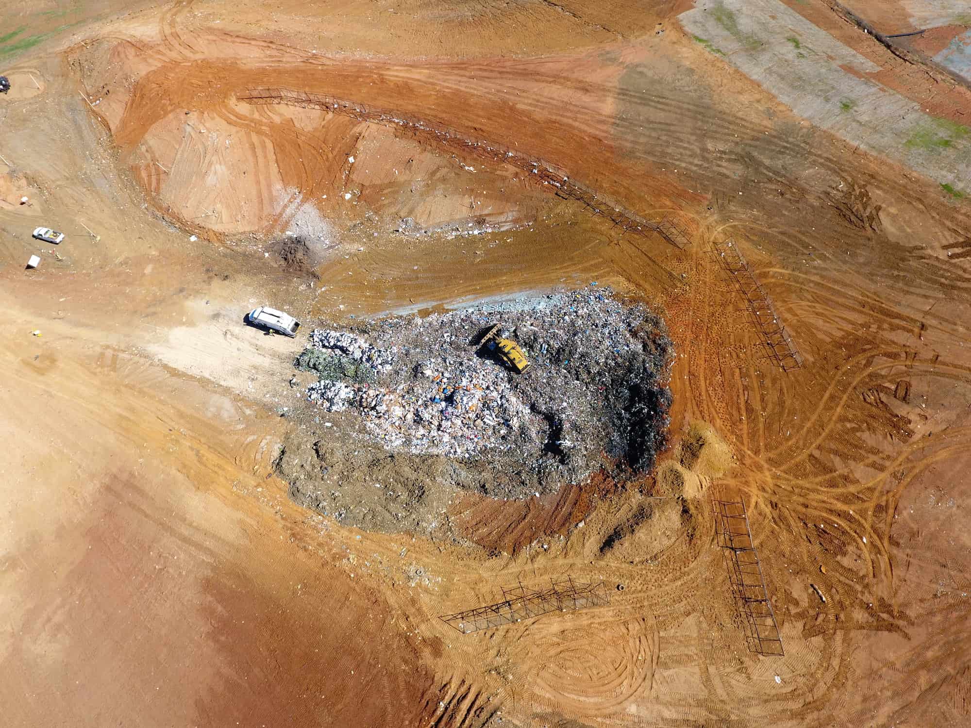
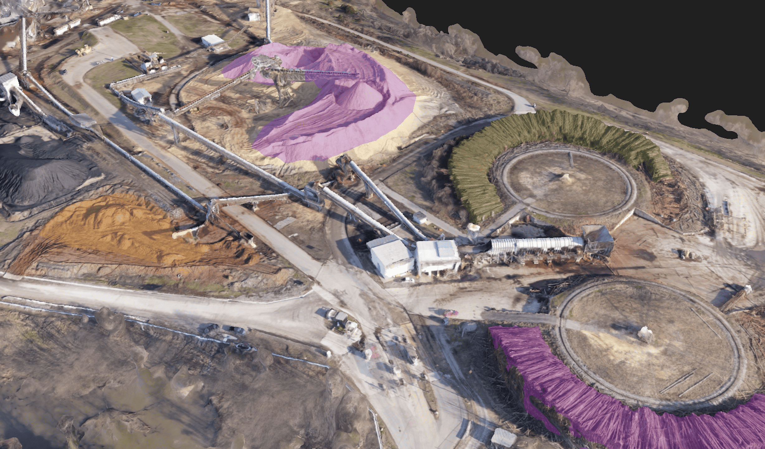
Increasing Landfill Measurements to Avoid Costly Mistakes
Leveraging regular, aerial drone landfill surveys provides timely compaction and airspace measurements, helping teams...
Electric Utilities
Firmatek improves reliability and drives down total interruption costs by providing actionable insights faster, safer, and more efficiently.
Your partner in safe, reliable, affordable power
At Firmatek, we understand what it takes to enable faster, more confident decision making in the electric utilities industry. Our approach to aerial data capture combined with real-time data processing empowers everyone from linemen to executive leadership to make in-the-moment decisions that improve reliability and drive down costs. We start each partnership by listening, then we apply our deep industry expertise to bring forward a tailored solution to improve data integrity and expedite problem solving.
Comprehensive analysis with actionable insights
By collecting data faster and safer through aerial drone technology, we empower preventative maintenance, drive down total interruption time and assemble a repository of electric line data that helps your better serve your customers. Kespry Cloud software makes it possible to democratize data throughout your organization, giving people access to the data and insights they need to make confident and timely decisions.
Firmatek Solutions for Electric Utilities

Comprehensive Visual Inspection
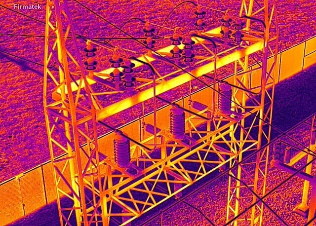
UAV-mounted, high resolution cameras can be used to capture still photos, thermal imagery, and videos to spot defects, anomalies, and change detection in structures, electrical components, and conductors.

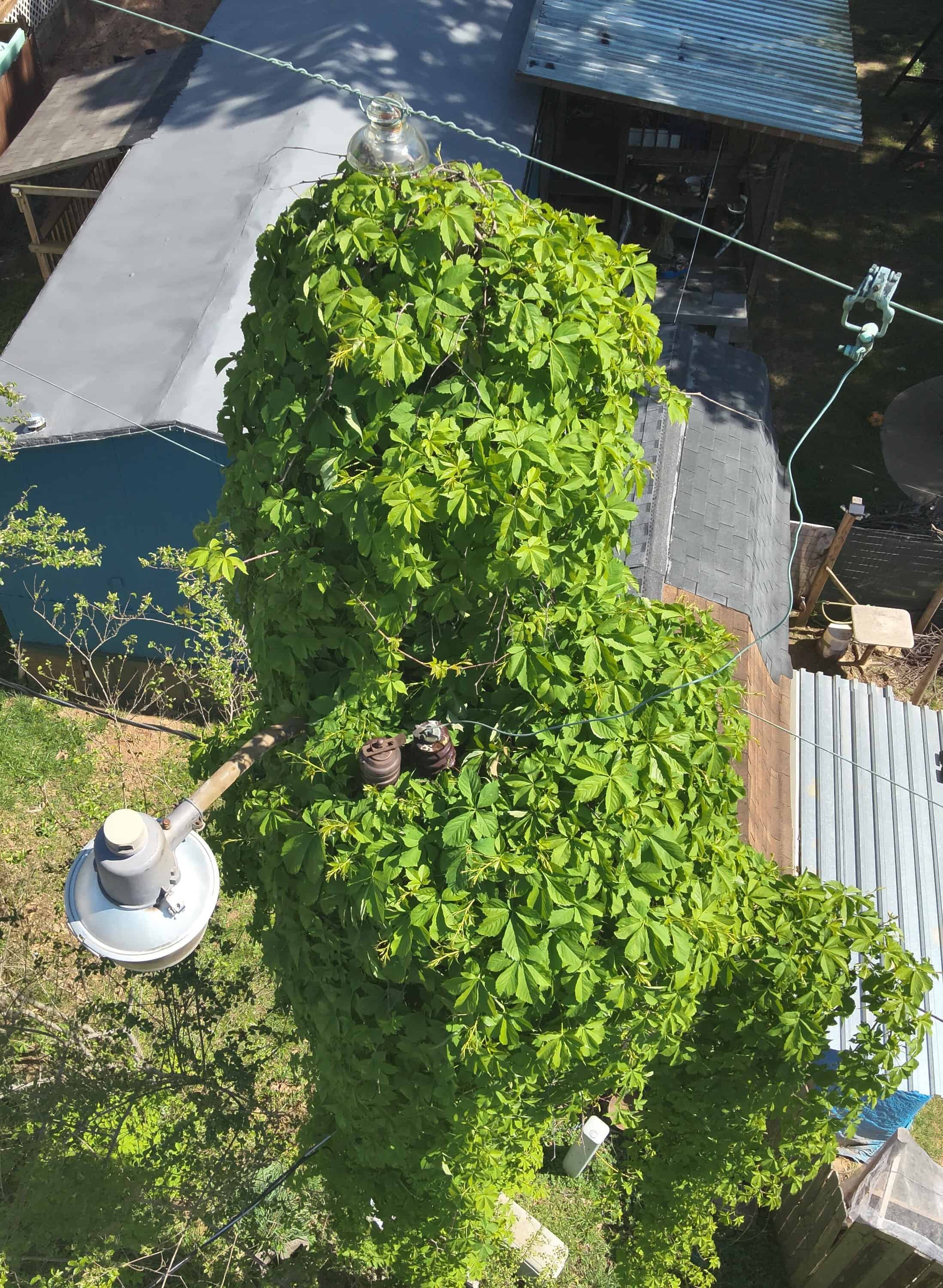
Vegetation Inspection
Our high-resolution cameras clearly identify potential vegetation encroachment as well as the closest structure, providing utility arborists with the insights they need to prioritize and execute vegetation management.

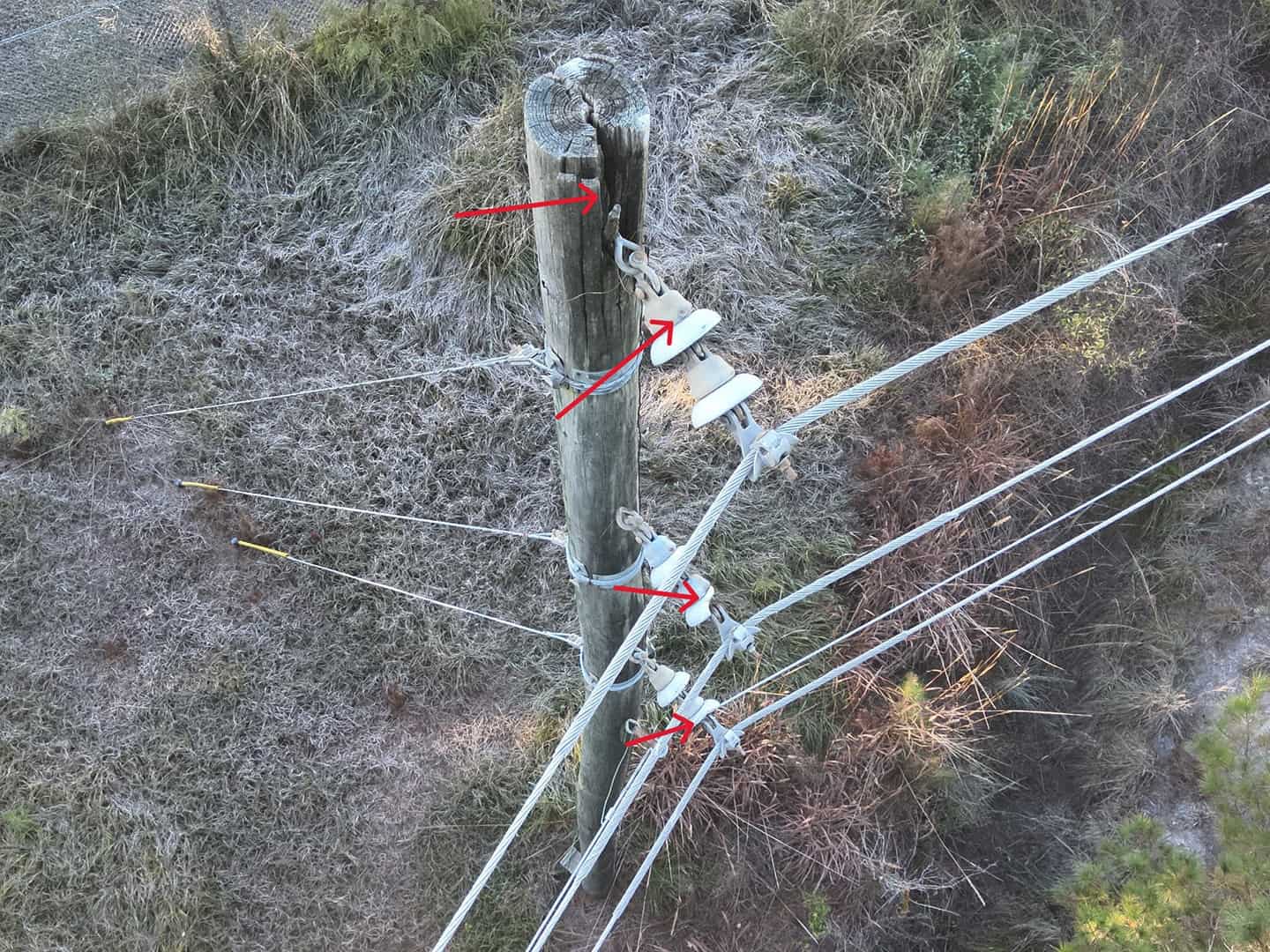
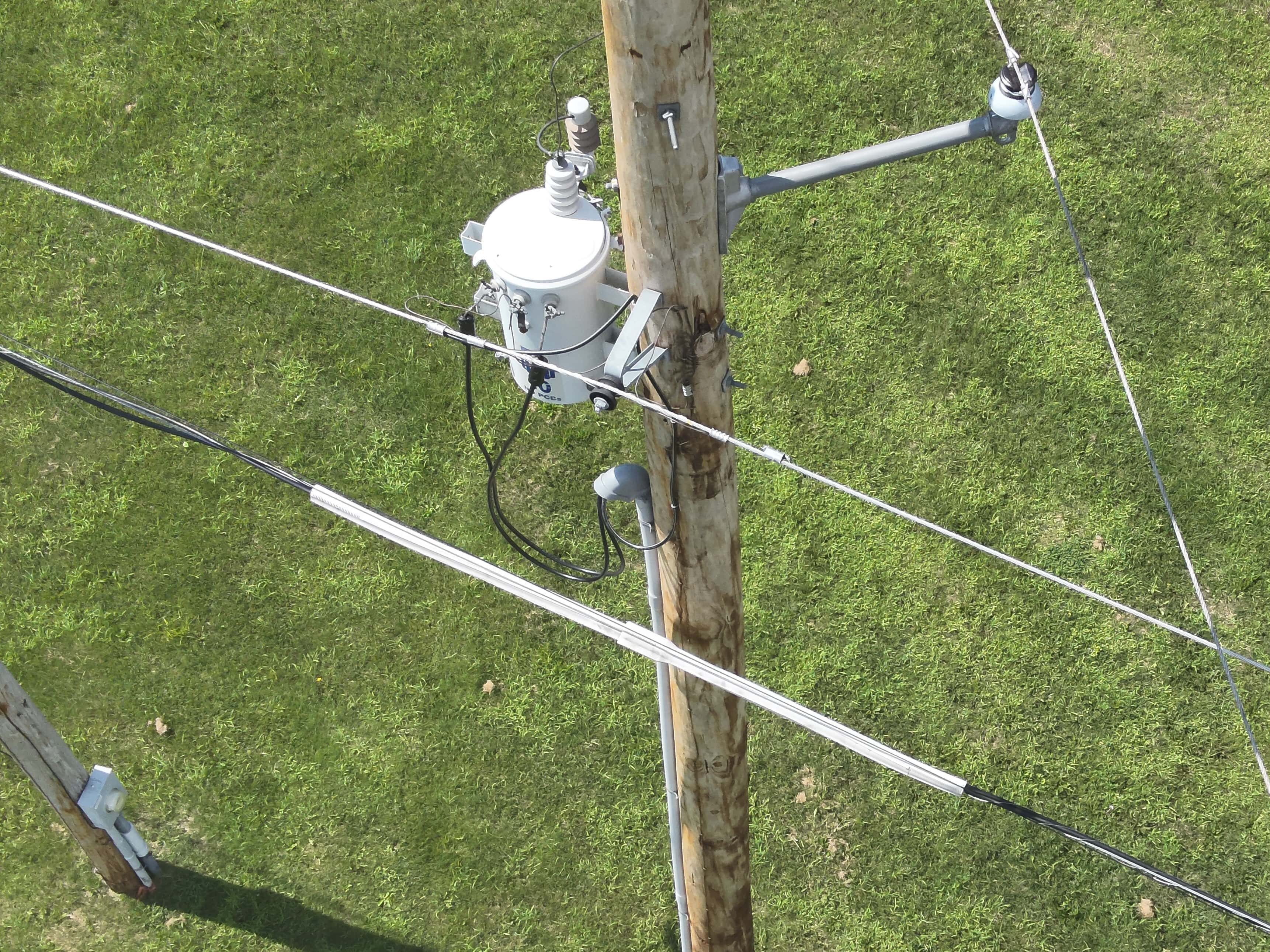
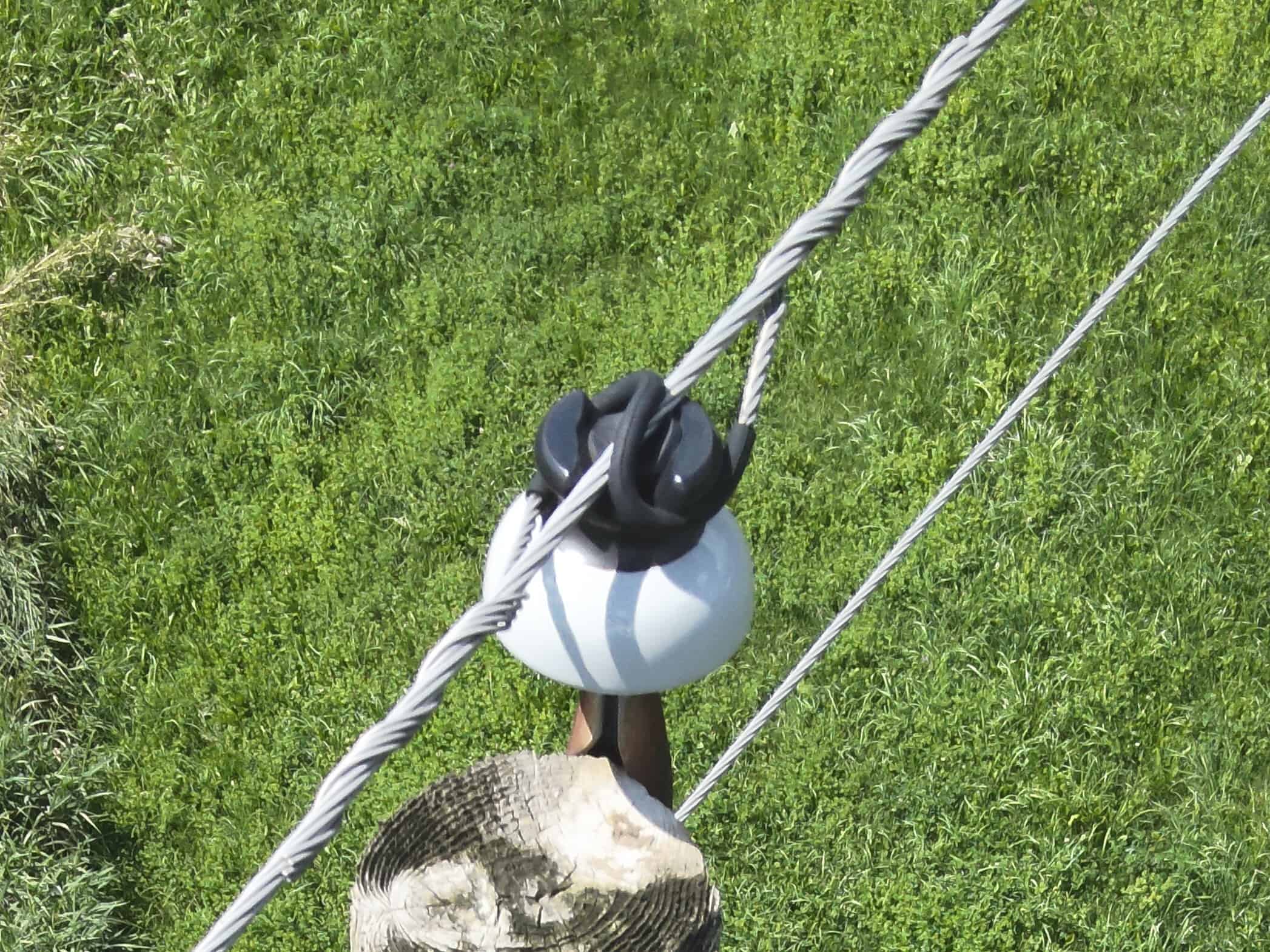
Infrastructure Audit
Use aerial imaging to audit joint pole use, units, conductor sizing, phasing, pole height or other infrastructure elements. Firmatek will provide the data you need to ensure regulatory compliance and validate and maintain accurate records.

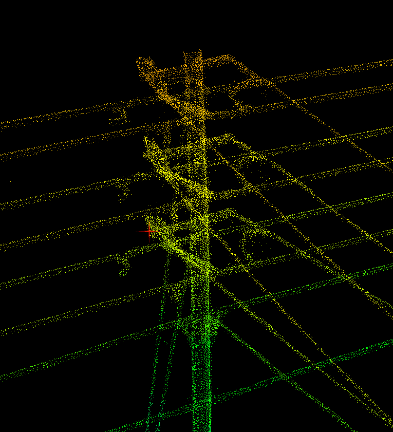
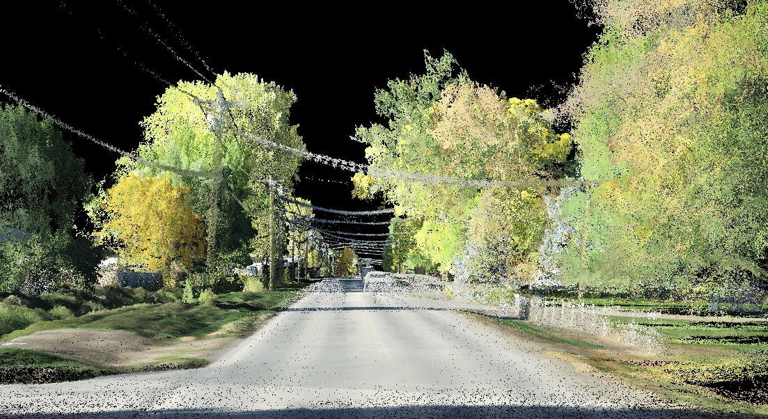
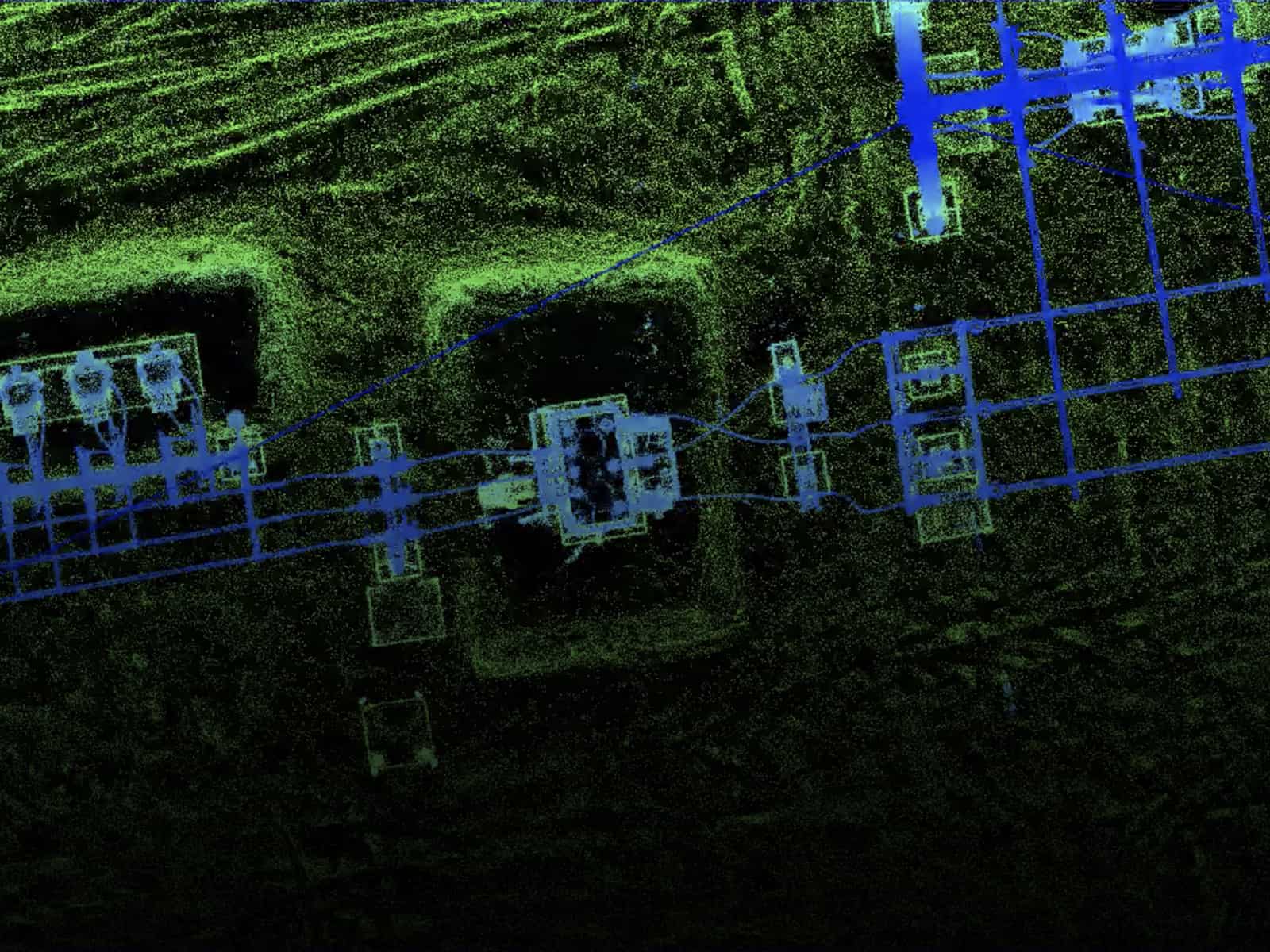
T&D Infrastructure Classification
Mobile and UAV-based LiDAR are used to capture 3D points clouds to assess infrastructure for transmission, distribution, and joint pole use applications.
Deliverables
Firmatek creates customized deliverables for the utilities industry and specializes in field validation, data validation, digitized physical infrastructure, pole loading capacity, and vegetation encroachment and right of way access.

How It Works
Job Planning
First, we discuss the job requirements and timing with you, then plan and schedule the job. Our field technicians come to your site and perform the data collection.
In-Field Data Collection
Firmatek uses industry leading tools including mobile and UAV based LiDAR, RGB and IR/thermal sensors for inspection, and photogrammetry for mapping.
Data Processing & Analysis
After the data is captured, we upload it to our processing and engineering teams for analysis and final production and publication.
Results & Insights
You receive deliverables, reports, and insights in Kespry Cloud. Our team is able to answer questions and help you turn insights into business intelligence.
Benefits of Firmatek for Electric Utilities
Time Saving
Faster access to real-time analytics via efficient data collection, automated processing, data analysis performed by experts.
Operating Efficiency
Frequent flyovers for analysis of pole structures, component failures and defects, asset locations, and ROW monitoring.
Installation Verification
Firmatek can easily and accurately map, monitor, and analyze your electrical infrastructure during and after installation.
Long Term Tracking
Utilize Kespry Cloud to track historical data over time for accurate utility asset planning, vegetation measurement, and financial analysis.
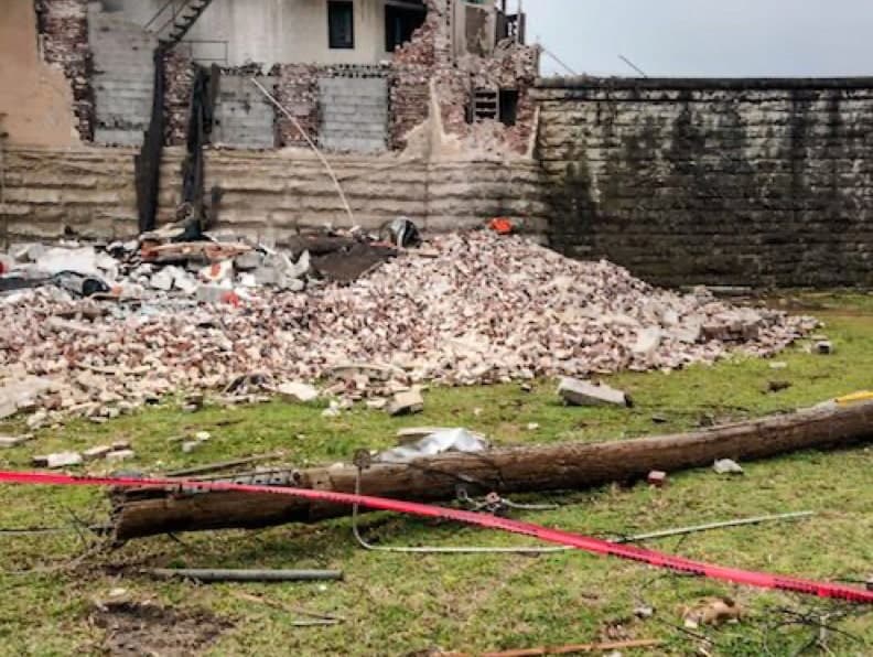
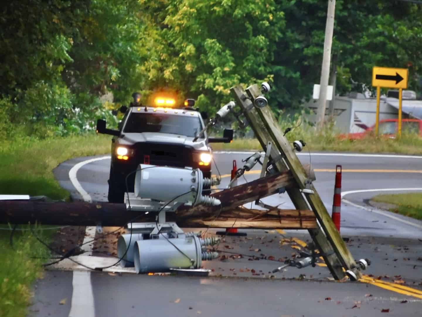
Storm Response
Assess storm damage, validating line up/down status, and document remediation efforts for rapid service restoration.
Streamlined Audits
Ensure regulatory compliance, validate and maintain accurate records, plan pole capacity for future fiber optic cable installations, and hold telecommunication providers accountable.