We’re excited to let you know about some of the new features that are being added to Kespry Cloud.
New Reporting Capabilities
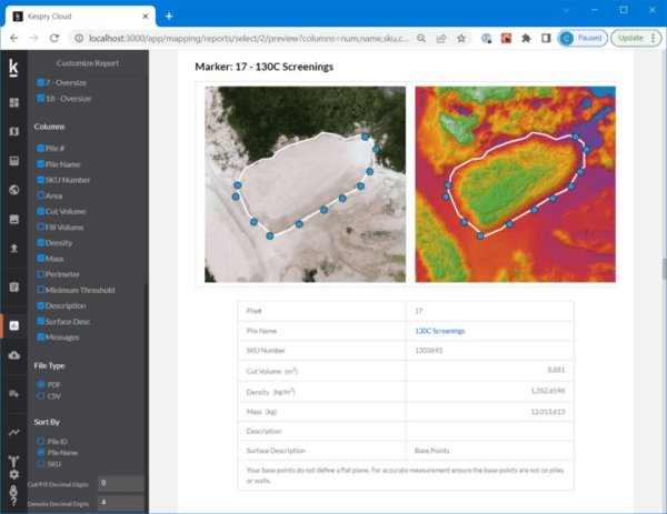
At the suggestion of our users, we’ve built out the reporting tool to allow users to customize the information they would like included in their report. Similar to the newly released Cross-Section Report Tool, users can decide to add or remove any piles they want from the report. They can also now choose to include or remove the overview map showing all the piles.
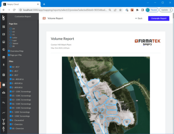
We’ve added a new feature that allows you to add a Digital Surface Model (DSM) to the report, as well as the ability to customize what data outputs you would like to see in your data tables, and how you would like the data sorted.
Renaming of Pile ID’s
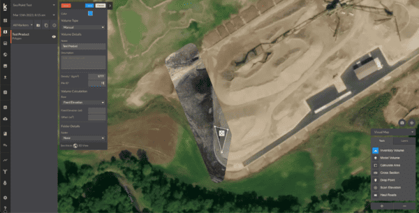
We’re also adding a new feature for users who want to be able to name their piles as they are drawing their polygons in the software. Now, when conducting an Inventory Volume over a pile, the user can manually rename the Pile ID to whatever they would like. This makes it easier to keep your piles and reports consistent from mission to mission.
Better Vertical Stitching Accuracy
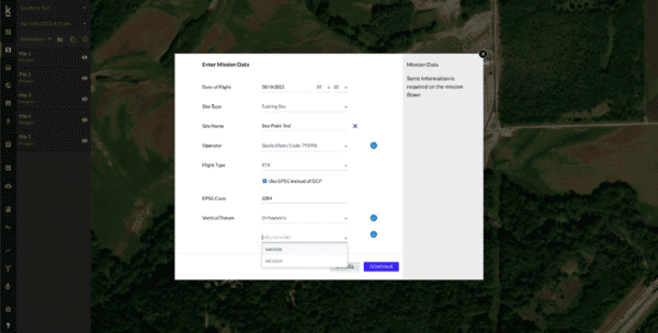
We know how important accuracy is to our clients, so we’ve improved our data upload interface to include the ability for users to select one of three different options for inputting their Geoid offsets: NAVD88, NGVD29, and the ability to enter the GEOID height manually. This not only helps improve the overall accuracy of the orthophotos and the DSM’s, but it also aids in visualization in both the 2D and 3D modes.