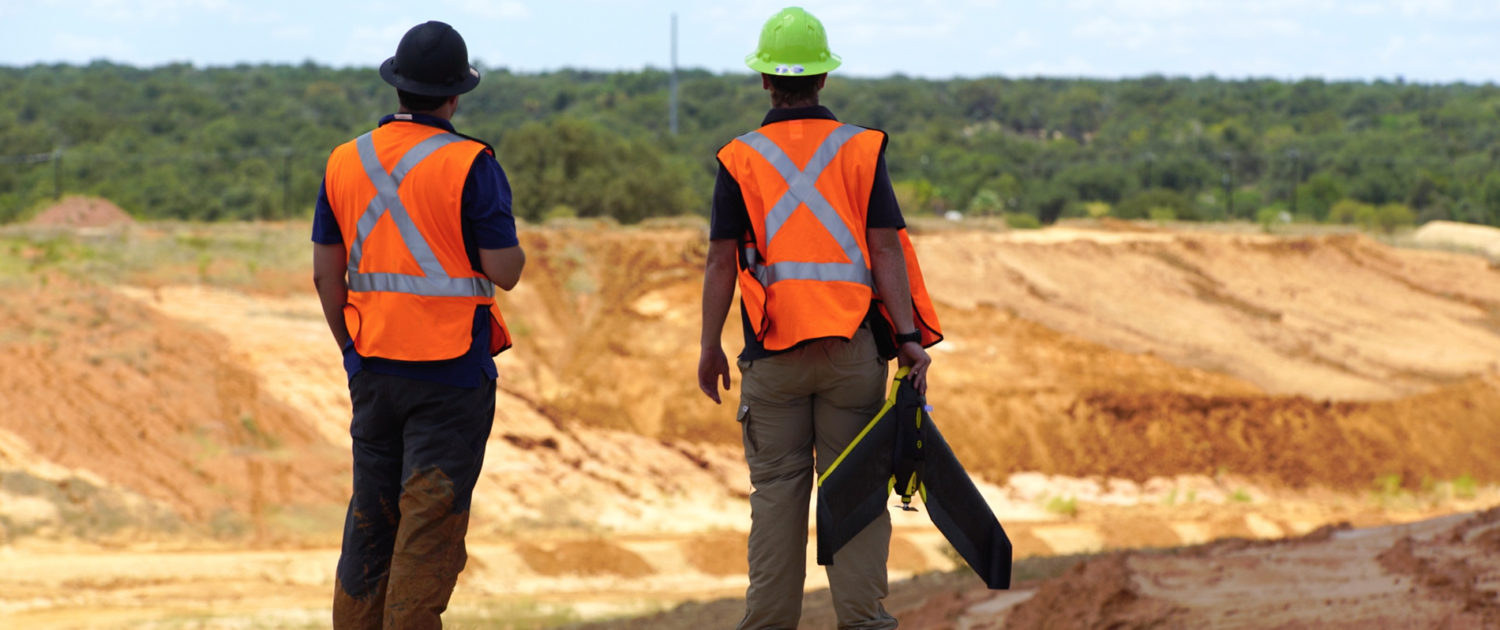
By Steele Olsen, Geospatial Field Technician
Serving our industry to the best of our ability requires us to act as trusted advisors to our clients. In an industry that’s flooded with new and improved tools and software systems, we aim to assist our clients in their decision making by providing key insights and custom solutions. Previously in our blog series, Guide to Drones, we covered different types of drone data and their use-cases, as well as how Firmatek decides which UAS platforms are capable of joining the fleet to better serve our clients. This week, we highlight some specific platforms that are currently in-use at Firmatek and discuss why they fit well within our clients’ operations.
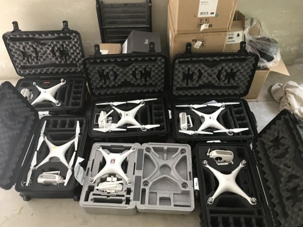
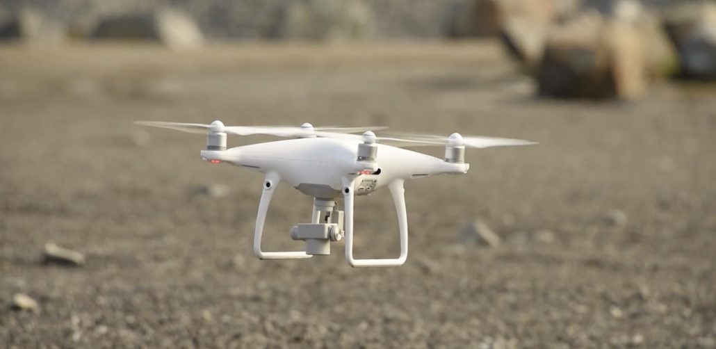
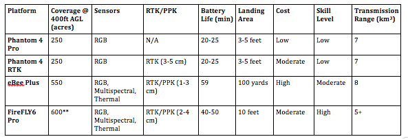
Phantom 4 Pro & Phantom 4 RTK
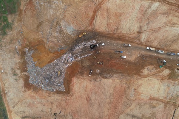
DJI’s Phantom 4 Pro (P4P) and Phantom 4 RTK (P4R) platforms have been a low-cost, reliable solution for our short-range small to medium operations (0 – 500 acres). Flight times can range from 20-25 minutes depending on weather conditions and on average, which allows us to fly an entire site using only one to two batteries. Limiting the number of flights per site reduces our on-site time and helps us hit multiple jobs quickly in a single day.
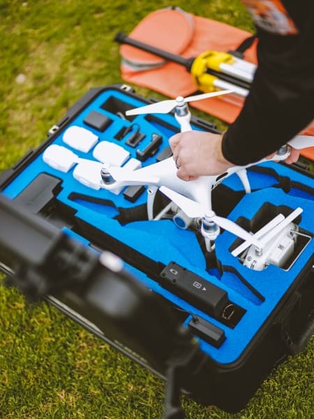
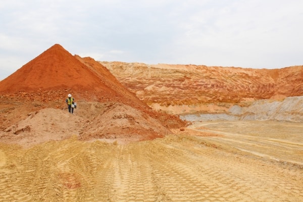
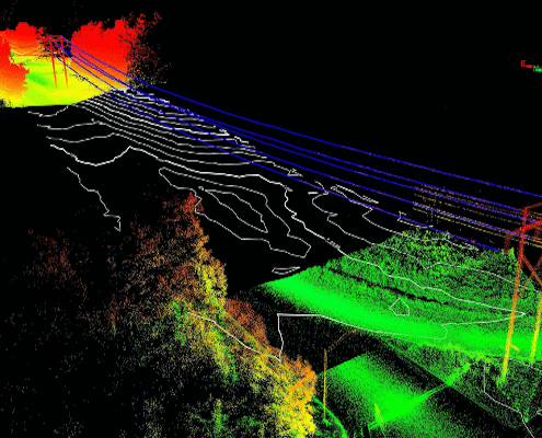
Our field technicians primarily use P4Ps to collect fill-in data for our ground based LiDAR scans. We rely on our drone data to fill in the gaps when our scanners can’t reach every shot necessary for complete data. When the camera is calibrated, the P4P/P4R’s 20MP RGB sensor collects data that scales very well with our LiDAR scans, providing seamless registration. Using the P4P/P4R platforms has reduced the need for climbing stockpiles to shoot pile tops, or hiking a scanner into a potentially unsafe area outside our truck.
The P4R is one of the newest platforms to be added to the Firmatek drone fleet. Where the P4P lacks in its ability to provide survey grade accuracy without the use of ground control points (GCPs), the P4R responds with its own proprietary RTK solution. DJI’s P4R D-2 RTK base station is compact, easy to use, and can achieve a horizontal accuracy of up to 3cm without GCPs. The P4R comes with its own display and is preloaded with the GS Pro mission planning software. One major benefit of the P4R’s GS Pro integration is its ability to create saved missions from KML’s which improves the consistency of repeated flights flown both by our clients and our own field techs.
DJI’s P4P and P4R are also our top picks for clients who use our drone solutions. Their ease of use and accuracy make them a great choice for clients who are typically flying less than 250 acres.
senseFly eBee Plus RTK/PPK
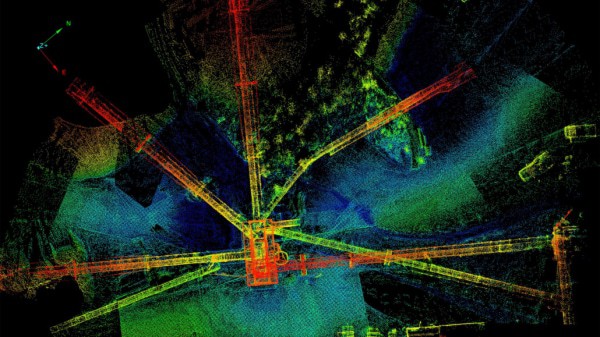
The senseFly eBee Plus is a mapping machine. We primarily deploy this model for our largest mapping missions. However, it preforms just as exceptionally during small to medium jobs if there is manageable space for a runway. This model is a mere 2.4 pounds, allowing it to fly for 59 minutes before it needs to land for a battery swap. Under great flight conditions, we have seen the eBee Plus map roughly five square miles of a river bed in just over six and a half hours. SenseFly’s eMotion3 flight management software acts as the brains of the drone, the mission planning tool, and the solution to post process your collected imagery with accurate geotags. The eBee Plus hosts a photogrammetrically optimized 20MP S.O.D.A RGB sensor that has provided us spectacularly reliable data. It can also carry multispectral/thermal payloads such as the Parrot Sequoia/senseFly ThermoMap, respectively.
With fixed wing UAS’s, there is an important caveat to consider: space. Like most fixed wing models, the eBee Plus requires the user to set aside space for a clean runway—in this case, around 300 yards for takeoff and landing. Although the eMotion3 AI is without a doubt state of the art, the drone will follow your command if you set the approach path into a cluster of trees. Well thought out mission planning is very important, especially when operating fixed wing platforms. If your sites is not be able to support a clear area that allows you to safely operate a fixed wing UAV, this may not be the solution for your needs.
BirdsEyeView FireFLY6 Pro RTK/PPK
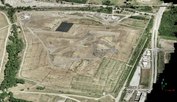
When we encounter a large job site that contains terrain or obstacles that would be catastrophic for an eBee landing, we deploy the FireFLY6 Pro. This unique vertical takeoff and landing (VTOL) model has the capability to transition from its multicopter hover mode to a fixed wing flight mode for maximum coverage. Takeoff and landing only requires a 10×10 foot area, which makes it ideal for large jobs with primarily rocky, vegetated, or unstable terrain that would normally shred a drone on a linear fixed wing landing.
Similar to the eBee Plus, the FireFLY6 Pro is able to house an assortment of different RGB, multispectral, and thermal payloads, allowing flexibility for jobs that require multiple types of data. Although the fixed wing transition is quite impressive, one aspect of this model that never ceases to amaze me is how quickly it maps. With a cruising speed of 15-18 m/s, the FireFLY6 Pro covers the extent of our larger landfill and mine operations in the blink of an eye.
The Right Tool for the Job
It is important to understand that simply determining your right tool for the job doesn’t end when you find the UAS platform that fits your preferences. Depending on your target industry, a successful workflow may require many tools that supplement the quality of your drone data. Choosing the appropriate drone photogrammetry software can have a large influence on the quality and accuracy of your client’s desired outputs. Shop around for software that will balance cost with your desired output(s).
Like in any discipline, it is valuable to maintain a healthy level of skepticism towards new methods and tools entering the industry. Don’t be quick to choose the turnkey solution for all of your projects without considering: “How could this product fit into all aspects of my workflow?”, “What caveats could this product have given my current workflow?”, “Why are other professionals implementing (or not implementing) this product within their own workflows?” and most importantly, “Would it be safe to operate this product given my current work environment?” Do your research. Selecting the right platform for your solution should not be a quick process and should be treated with the upmost care. Finding your balance between cost, quality, and efficiency is important, but determining if the products you choose can be operated safely on your site should ALWAYS be considered your top priority.
While we highlight features of four drone platforms that Firmatek chooses to deploy, continue to ask yourself the questions from Part 1 of this series:
- What type of information am I looking to get from a UAV?
- What are the requirements for achieving this information?
- What sensors?
- What level of accuracy?
- Will I be performing repetitive work or one-off projects?
- How large of an area will I need to fly?
- What is my skill level (or my pilot’s)? How complex do I want my solution to be?