By Andrew Maximow, Chief Drone Officer.
As with any new technology, myths tend to creep out of the woodwork causing confusion and misunderstanding among potential end-users. As these myths gain steam, they raise doubts in the marketplace, which ultimately delay purchase and implementation decisions. This seems to be particularly true with the commercial application of drone technology. The commercial drone industry has a number of complexities that have contributed to the creation of these myths. With these flying robots, software, and GIS working together, in addition to a regulated environment and rapid development of technology there is bound to be some confusion and misunderstanding. It seems there’s a new drone, app, or system being introduced every few weeks. How can one possibly keep up and separate the truth from the hype?
At Firmatek, we strive to be hardware agnostic and consider the drone as a data collection device. We are focused on the data analytics and the insights derived from the data being collected by drones. It’s not about the drone for us at Firmatek. The drone is a great tool, and it’s a means to a greater end. With this perspective in mind, let’s debunk 3 popular myths about drones in the commercial & industrial space:
1st Myth: The DJI Phantom 4 Pro drone is not suitable for professional, commercial use.
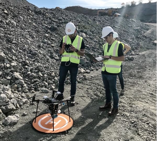
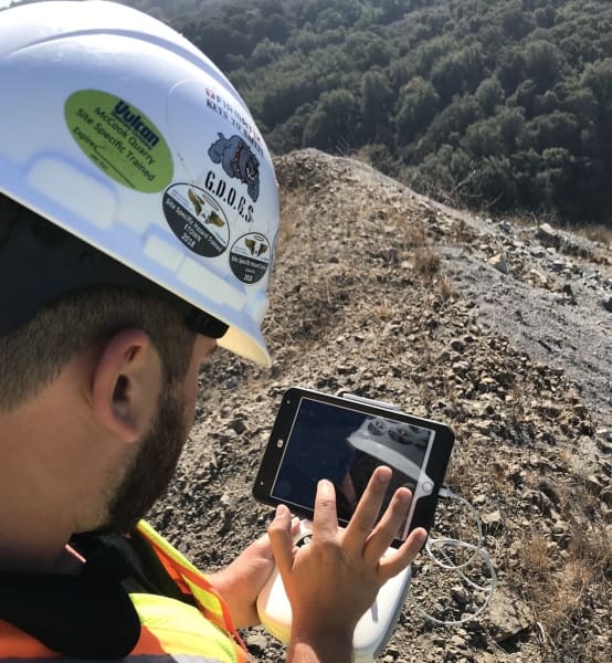
Blog posts, online forums, and other social media feeds are chock full of comments berating the DJI Phantom 4 Pro (P4P). For example, some call it unprofessional or not commercial grade, others a toy not suitable for industrial work. That may be the case for some applications, but for 3D Mapping applications of areas up to about 300 acres in the mining, aggregates, landfill, and earthworks industries, the P4P is the right tool. I would argue there is no other drone on the market within that price range that can compare to the quality and consistency of results as the P4P. The camera (20 MP, 1 inch sensor, mechanical shutter), combined with the DJI GO and GS Pro apps, handle varying lighting and environmental conditions and produce clear images necessary for photogrammetry-based 3D mapping. Additionally, the GS Pro app is well suited for creating and repeating fully autonomous flight plans.
Know how to use it properly. Know what it can do. Respect its limitations.
Another frequent comment is the P4P doesn’t produce accurate results. Like most smartphones, the onboard GPS on most off the shelf drones is not very accurate, and the resulting imagery is not accurately geo-referenced. This means that the x, y, z coordinates may be off by several meters, which is not conducive to making accurate linear, area, and volumetric measurements. Because of this, Firmatek incorporates ground control with GCP (ground control point) placement to produce accurate geo-referenced results. We’re confident that onboard RTK/PPK technology that is being integrated in fixed-wing and multi-rotor drones will virtually replace the need for ground control.
At Firmatek, we take one more step to ensure a high level of accuracy and consistency of our data analytics deliverable. To account for minute differences inside the drone camera that may impact focal length, we calibrate every single drone camera that gets deployed to the field and apply those unique camera parameters every time we process the data collected by the drone, either in Pix4D or PhotoScan software. (If you want to learn more, we’ll be doing an upcoming blog post on camera calibration details.)
2nd Myth: For serious industrial work drones need to be complex and expensive
A few weeks ago, a sales guy was trying to pitch me on a new tail-sitter style VTOL (vertical take-off and landing) drone that costs over $30,000. It’s mapping, it’s a VTOL, and it also flies for over an hour. I asked him about the data and why it’s better than other drones. “You should see the data,” he said. “It’s stunning.” Stunning? What does that actually mean? He couldn’t tell me.
This myth that the sales guy I talked to last week, and many others, are peddling is that you have to have these big expensive drones in order to do the work. At Firmatek, we believe in the right tool for the right job. There may be some applications for which you need a complex and expensive drone. However, we have found that those jobs are few and far between. The majority of jobs can be done with much cheaper, effective, and simpler pieces of technology. But like with all technology, you do need to use it correctly.
Another reason we like to deploy the DJI P4P is the ease of use. It doesn’t require any special piloting skills and hours of training. One can learn to fly the P4P right out of the box, and quickly program autonomous flight plans that allow the drone to essentially fly itself.
3rd Myth: More Mega Pixels are better
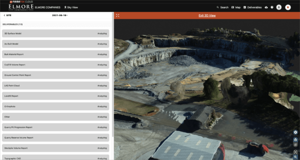
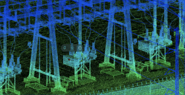
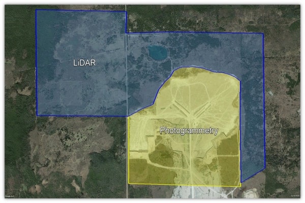
One of the most mature components of drone technology is the camera and gimbal. DJI has done a great job of miniaturizing and optimizing camera and gimbal tech, which may have outpaced other components of the drone. The resolution and stabilization is amazing on the Phantoms and Mavic series of drones, let alone the interchangeable payloads such as the X4s, X5, X3 and so on. At 2o MP on the P4P drone, you get more than enough mega pixels for 3D Mapping deliverables, such as volumetrics, pit scans, cut & fill, and topo CAD drawings. At Firmatek, we spend time and effort actually reducing the point cloud density from about 1 point per inch to about 1 point per foot. We have done testing, and found that we could maintain the accuracy while making the data processing more efficient by reducing the point cloud size. Firmatek has tested hundreds of 3D scans performed via drones and photogrammetry against LiDAR data and we have concluded an accuracy that is well within 5%.
Myths Debunked
At Firmatek, we are patient and diligent in our approach to implementing new technology. We work with our internal experts and our clients to develop best in class solutions. In an industry where technology is constantly evolving, you can’t just listen to what everyone is saying about the technology. You should listen, learn, test, and verify. Then make the decision that is best for your company and your clients.
What we have found by doing this is that you don’t need fancy, complex, and expensive drones to collect data for many basic 3D mapping projects. A DJI P4P, when properly used, produces great data that we can use to give our clients the insights and analysis that they need to run their business.