By Andrew Maximow, Chief Drone Officer
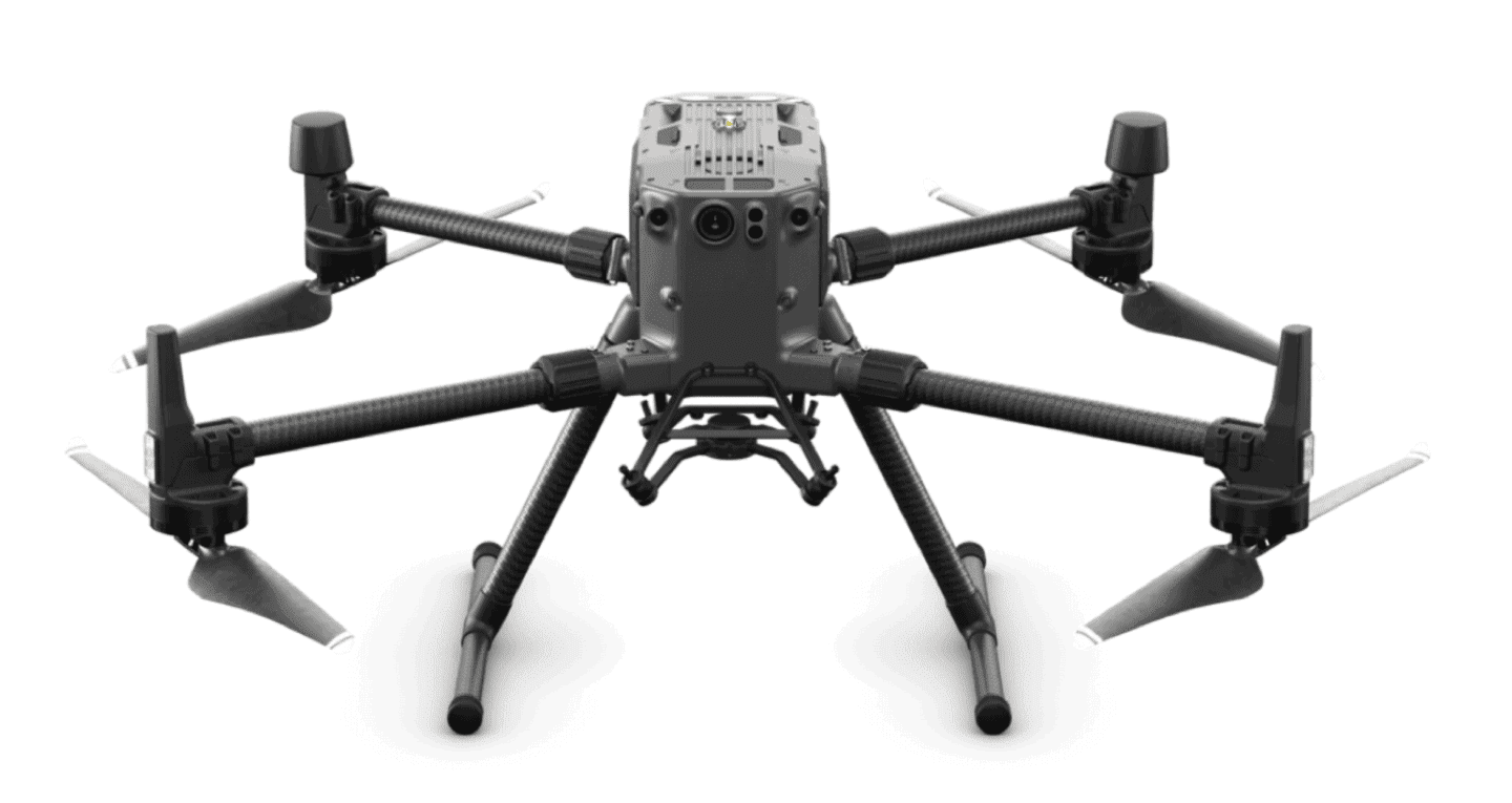
DJI raised the innovation bar last week by launching the M300 drone platform, designed for Public Safety and Industrial Inspection use-cases. While it’s packed with new features and new camera payloads, it’s promise of usability in nearly any environment comes with limitations. In this review, I’ll highlight key platform features and discuss a few drawbacks this technology presents.
Despite the lack of mapping support, there are some interesting new camera payloads introduced by DJI. The fullest potential of these new sensors is not clear at the moment, but it is clear that DJI is fulfilling its promise of owning the entire technology stack from vehicle, to payloads, to flight planning software, to data analysis. Here are the M300 platform features that I really like:
- Fully autonomous with a high degree of accuracy and precision.
- RTK navigation and positioning.
- Waypoint 2.0, providing live mission recording for repeatability.
- AI-Spot Check, marking objects of interest and replicating positions, framing and angles.
Other features include OcuSync Enterprise, which allows multiple controllers to have a smooth “hand-off” between two PICs at an extended range of approximately 10 miles. Additionally, this platform promises up to 55 min flight time, with ruggedized IP45 weather tolerance, hot-swap batteries.
Sadly, this new platform does not support mapping, despite being backwards compatible with the XT2 and Z30 cameras. This could have been a tremendous opportunity to have a product that fills the need for a 300-500 acre mapping drone. That acreage is too big for Phantoms, requiring multiple battery swaps, and too small to justify a fixed-wing. Support for the good ‘ol X4s (20 MP, 1″ CMOS sensor, mechanical shutter) genre of cameras would have been great!
There are likely two reasons the M300 is not mapping compatible. First, DJI addressed the needs of two popular markets, Public Safety and Industrial Inspection. Services in these markets are primary focused on situational awareness and high resolution imagery. Yet this technology seemingly ignores accident reconstruction and thermal and RGB mapping use cases.
The second reason is that the 3D mapping market is still remarkably fragmented with volumetric analysis for mining/aggregates and BIM for construction. For example, the construction industry has historically been slow to adopt BIM technology, that is until the COVID19 pandemic forced the industry towards remote sensing technology for the work that is traditionally handled by teams of superintendents, site managers, and trades experts. Oddly enough, COVID19 may have been the catalyst needed to increase adoption of drone-based 3D mapping in the construction industry. We shall see if it continues or reverts back to its old ways.
In conclusion, while DJI’s M300 drone is sure to be a beneficial tool for Public Safety and Industrial Inspection industries, there are limitations to utilizing this drone in mapping operations. We are hopeful that DJI will include mapping capabilities in the M300 platform either by supporting legacy cameras or offering a new type of camera suitable for mapping.
Image Attribution: DJI Matrice 300 Drone. Image from Covert Drones.
About Andrew 
Andrew Maximow joined Firmatek as Chief Drone Officer. Andrew spent his professional career in fast-growth technology domains, progressively moving from engineering to leadership roles. Prior to joining Firmatek, Andrew served as a managing partner with Texas-based drone services company, Drone Dynamics, and led the Enterprise Services team at 3D Robotics. Andrew possesses BS & MS degrees in Industrial & Systems Engineering.
Recent Articles:
Implications of the Recent FAA Remote ID Proposal
Is the Construction Industry Ready to Digitize?


