Tailored Engineering Solutions
Deliverables
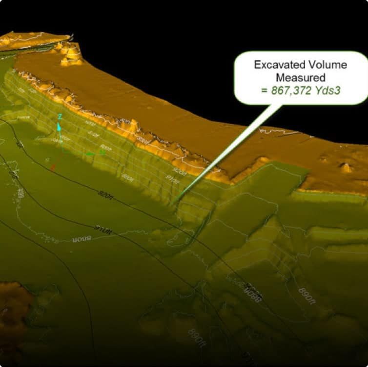
Cut & Fill Calculations
Knowing the volume of material that has to be removed or delivered for a project is critical for preliminary planning, scheduling and cost estimation.
Geospatial data capture provides a fast, safe and highly accurate means of gathering data of the existing conditions. Digital files can be delivered directly to the client, or used to calculate volumes in-house.
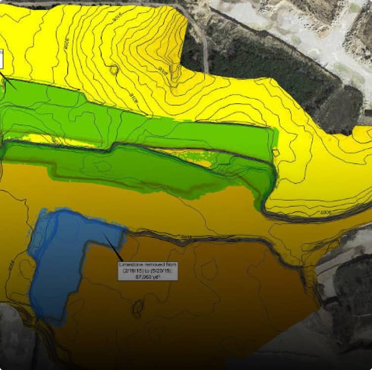
Overburden Volumentrics
Whether you’re a mining company using a contractor for overburden removal or the contractor moving dirt, money changes hands based on the amount of dirt moved. Using an independent and accurate third party gives everyone confidence in the numbers. We scan the areas before, during and after a contract to verify the amount of dirt moved. With this data, we can calculate volumes, track changes, and provide you with before and after overlay images.
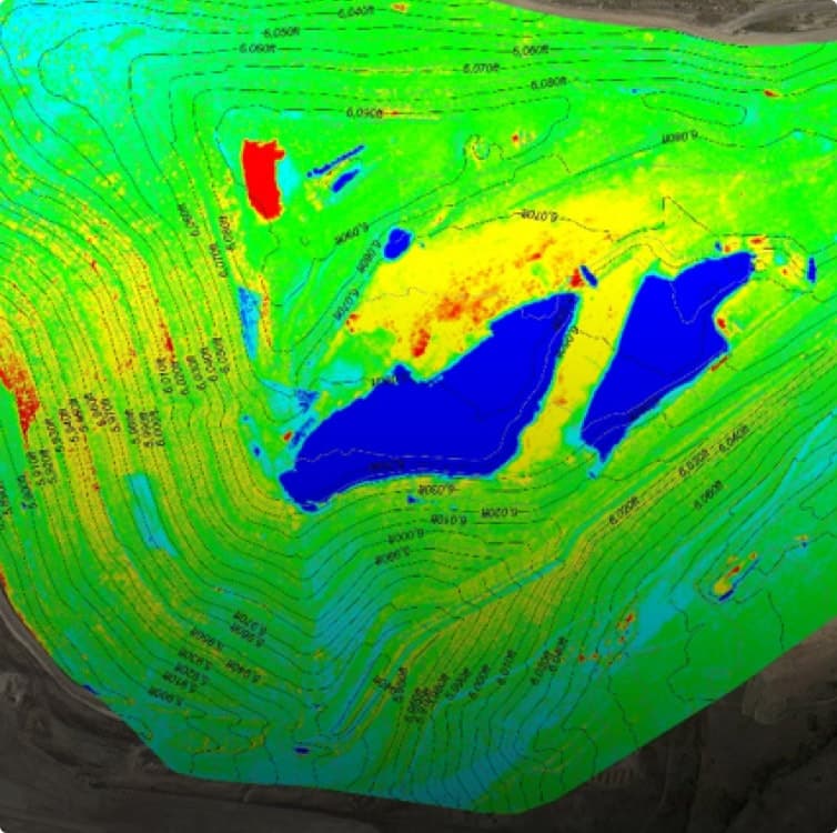
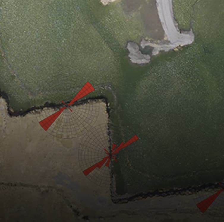
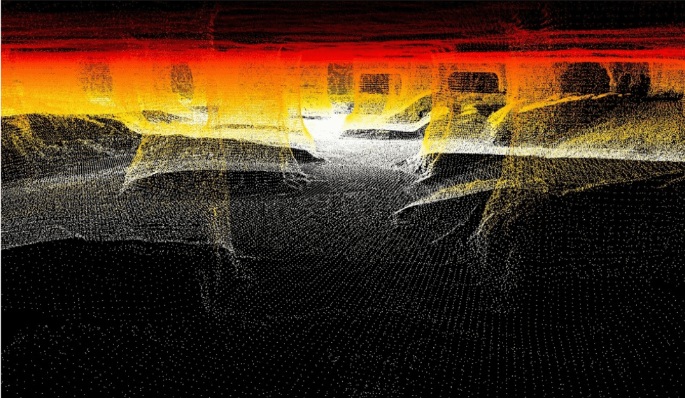
Change Detection
Collecting high-density spatial data is a more accurate method than single-point surveying for monitoring changes in the earth’s surface. Valleys, troughs, toes and crests are captured in much higher detail. Our advanced data capture technology is a faster and safer means of field mapping.
Drainage Studies
An accurate hydraulic model always starts with the right existing topography. Whether it’s undeveloped land, a highly disturbed area or natural drainage paths, we capture, contour and deliver the data that builds your model.
Geotechnical Analysis
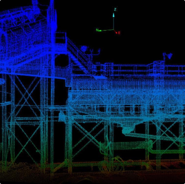
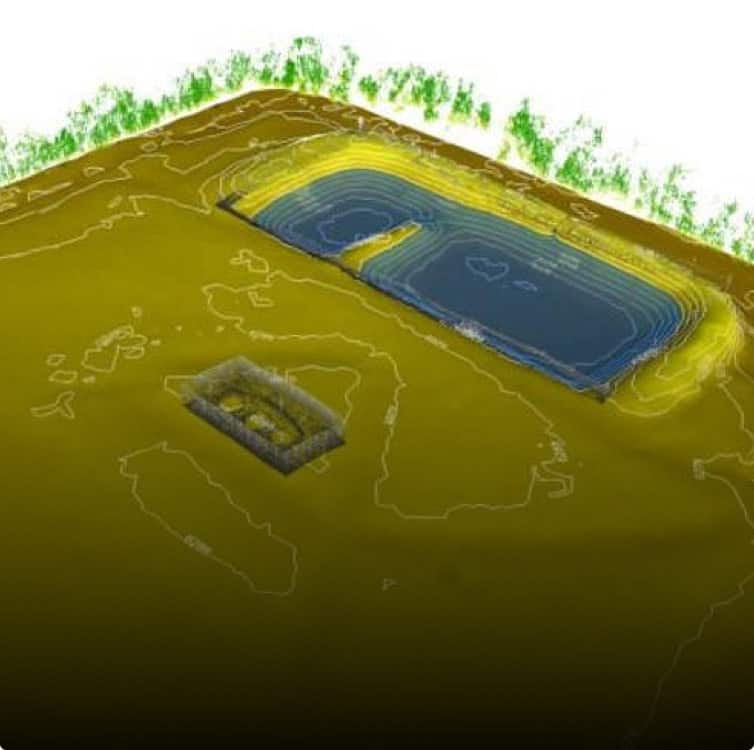
Detailed As-Builts
High resolution laser scanners are used to create 3D point clouds that represent a highly accurate and detailed “as-built” of an area or object. Data points can be captures on mechanical features such as equipment and on structures. Topographic data capture can be performed to record the as-built condition of earthwork projects such as ponds, dams, levees, berms and areas where stripping has been completed.
Industries We Serve

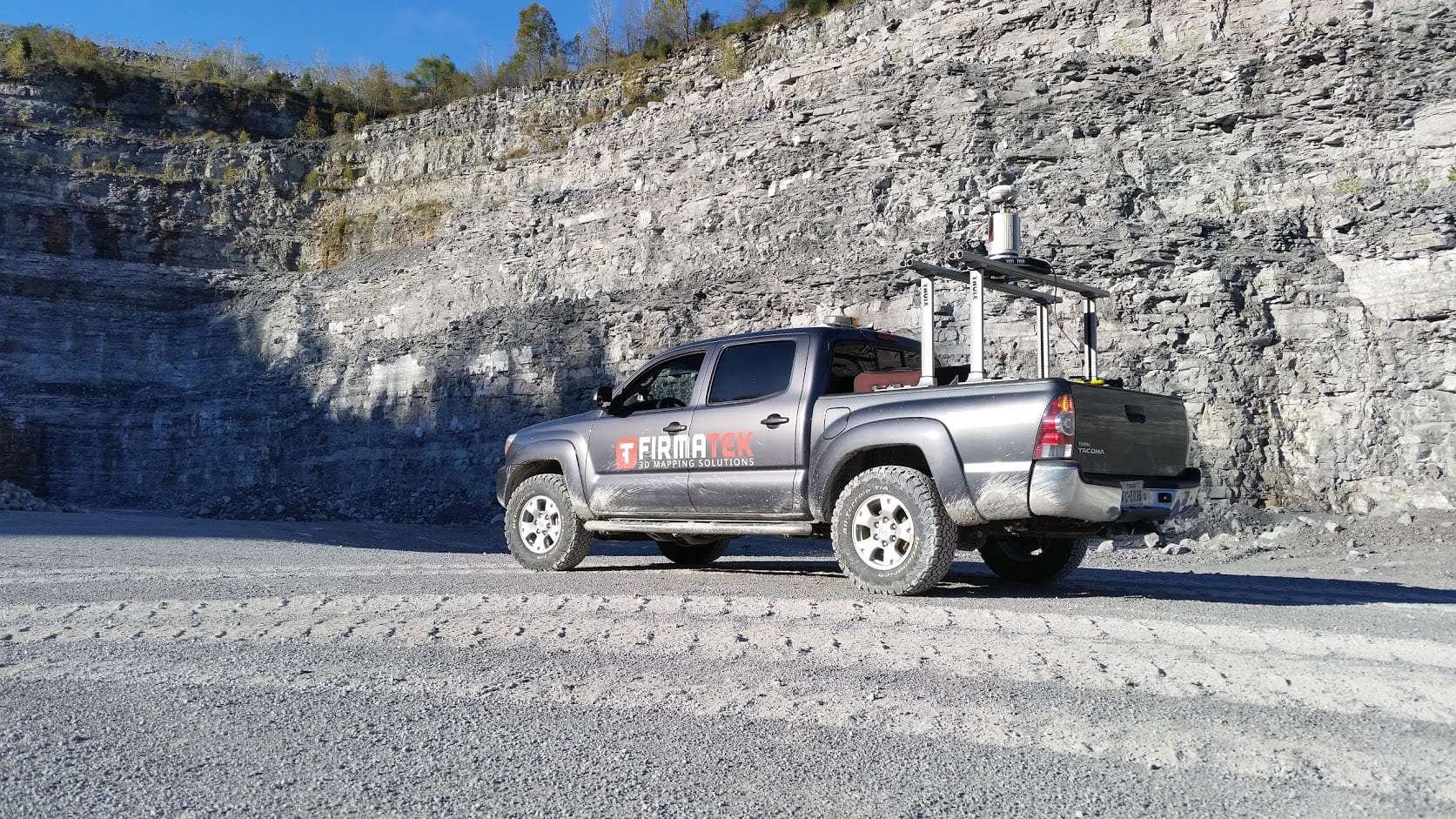
Mining and Aggregates
Leading the industry in stockpile measurement and inventory management for the aggregate mining industry for 30 years, serving 14 of the top 15 producers.

Landfill & Waste Management
Helping landfills maximize and manage their airspace and densities. Firmatek is the national provider of data collection and analysis for one of the largest solid waste companies in the United States.

Electric Utilities
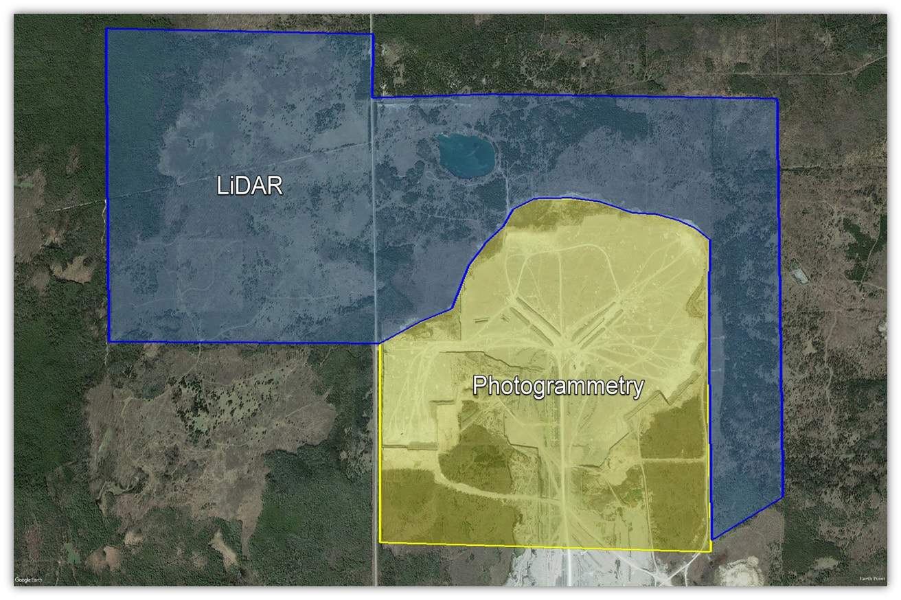
Meeting the needs of transmission and distribution line utilities. We use LiDAR and photogrammetry to collect data for right of way vegetation management, joint use pole audits, and comprehensive visual inspections.

Disaster Response
Collecting aerial imagery with real-time data processing capabilities provides a comprehensive understanding of the conditions at hand in a safe, timely manner. Our team of experienced field technicians is fully equipped for continuous operations and rapid deployment.

Construction
The use of LiDAR and aerial data imagery on construction sites is an innovative approach that can identify better work practices, highlight safety issues and provide a new perspective to owners, contractors and investors.

Contact Us
Get the most out of aerial data and transform your site data into powerful insights.