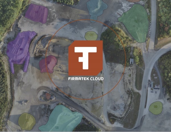
Kespry helps landfill operators improve their site operations
The ever-changing physical state of landfills creates complexity in operating them and this constant change has a dramatic impact on the operational success of each site. We provide technology, information, visibility and key insights that give landfills the confidence to make decisions with more current information. In that pursuit, we are integrating a cloud-based GIS and data processing platform into Firmatek’s current internal workflow, as well as offering this system to our solid waste clients and the industry as a whole. The system is Kespry Cloud and we are moving to host, process, display and deliver all data, results, mapping and reporting through this cloud-based system.
For dynamic operations like landfills, to do something as simple as cut a cross section, measure an odd-shaped area, get a precise surface elevation at a specific point, or measure the volume of a stockpile, you need to use the digital data, not just a PDF map or paper document. In the past, this digital mapping data was sent to someone with a CAD or GIS program installed on a high performance PC and with access to the right software licenses. With every advancement in hardware and software, geospatial data and the resultant knowledge becomes more accessible to a larger group of people. These types of measurements and analytics are now available to everyone from local site managers all the way up to corporate executives, without the need for technical knowledge or special programs & licenses. They are available to everyone, everywhere, all the time in the Cloud.
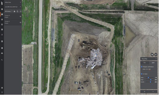
Kespry Cloud offers the ability to work in an intuitive user interface with rich 3D data derived from drones, laser scanners, Lidar, photogrammetry, point clouds and design CAD. A few of the tools and functionality available to solid waste clients through Kespry Cloud are:
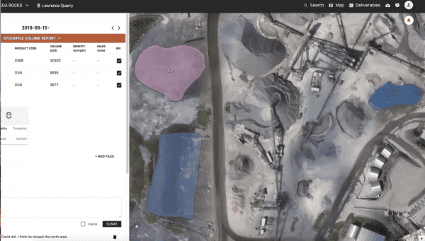
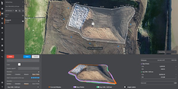
Soil stockpile measurements including the current material volume and the change between flight dates. The base used to measure the pile volume can be set at one elevation, interpolated from surrounding elevations, or measured against a design or previous surface. The results include a 3D preview of the pile surface and the base it is being measured against.
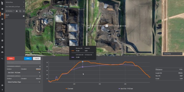
Cross sections can be cut to quickly compare multiple surfaces including the current topo, previous topo, top of waste design or subgrade surface. This cross section view includes information on the vertical distance (e.g. fill depth or remaining airspace depth), as well as the length and average % grade across the section.
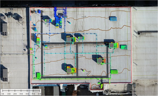
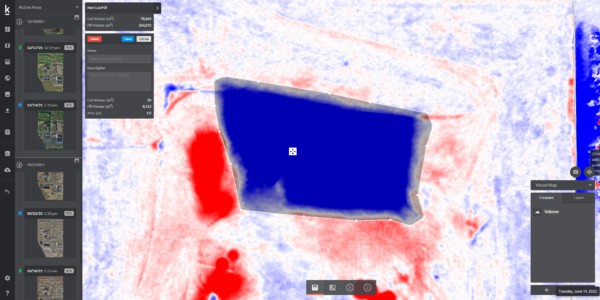
Change Detection analysis is one of the most powerful features of Kespry Cloud, it uses automatically colorized change detection maps to identify cut & fill areas and generate volume takeoff quantities. You can quickly compare two surfaces (topo or design) to visually identify all areas of cut (red) and fill (blue) for the entire mapping area. Choose between any combination of mapping dates, and design files to generate a comparison between the two datasets. This functionality can be used for fill volume calculations, soil use, settlement, remaining airspace volumes, cell & road construction quantities just to name a few uses.
Other tools include:
- Contour generation
- Spot elevations
- Distance & area measurement
- Road slope analysis
- Spot Note communication tool
- 3D surface viewer
- Contour Generation using one-button click
All polygons, lines, notes and measurements created on Kespry Cloud can be saved, exported and shared to be used the next time or for communication about site tasks.
A major differentiator is that Firmatek offers a complete solution for all mapping and geospatial needs. The Kespy Cloud can be used as:
Complete DIY – Client flown, Kespry hosted, Client processed
Hybrid DIY – Firmatek or Client flown, Kespry hosted, Firmatek or Client processed
Full Service – Firmatek flown, Kespry hosted, Firmatek processed
We will continue to run our nationwide, full-time field crew, to capture data as part of our full-service offerings, but now that data will be automatically populated onto Kespry Cloud where staff from across all geographic areas and organization levels will have access to cutting edge 3D tools. These features will be available on-demand and with unlimited use, allowing everyone across the organization to have visibility of current site conditions and progress, regardless of their technical knowledge, education or past experience. This geospatial data and the resulting insights are changing the way waste services companies operate their landfills.
Caleb Cass, PE. Caleb has been working with clients in the solid waste industry for over a decade. He has helped Firmatek create and deliver unique products and services to our landfill clients over the years. Caleb is working with clients to ensure Kespry Cloud continues to deliver new, innovative, and useful software to the industry.