Data Processing as a Service
Already have your own drone or scanner? We can help you with the data processing and analysis. You can use your own equipment and upload the data to us for processing. You don’t have to deal with time consuming and complex software. Just tell us what insights you are looking for, and we will get you the information you need. Whether it’s a stockpile or inventory measurement, a point cloud or aerial image, or a complex engineering project, we will use the data you collect with your own equipment to get you a deliverable that provides you with the insights you need to run your business.
How It Works

Industries We Serve

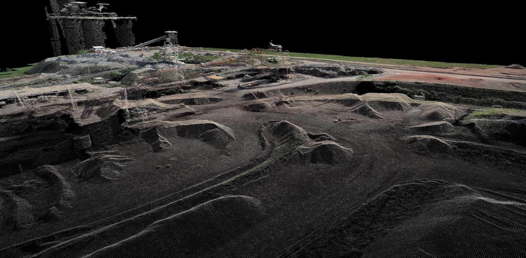
Mining and Aggregates
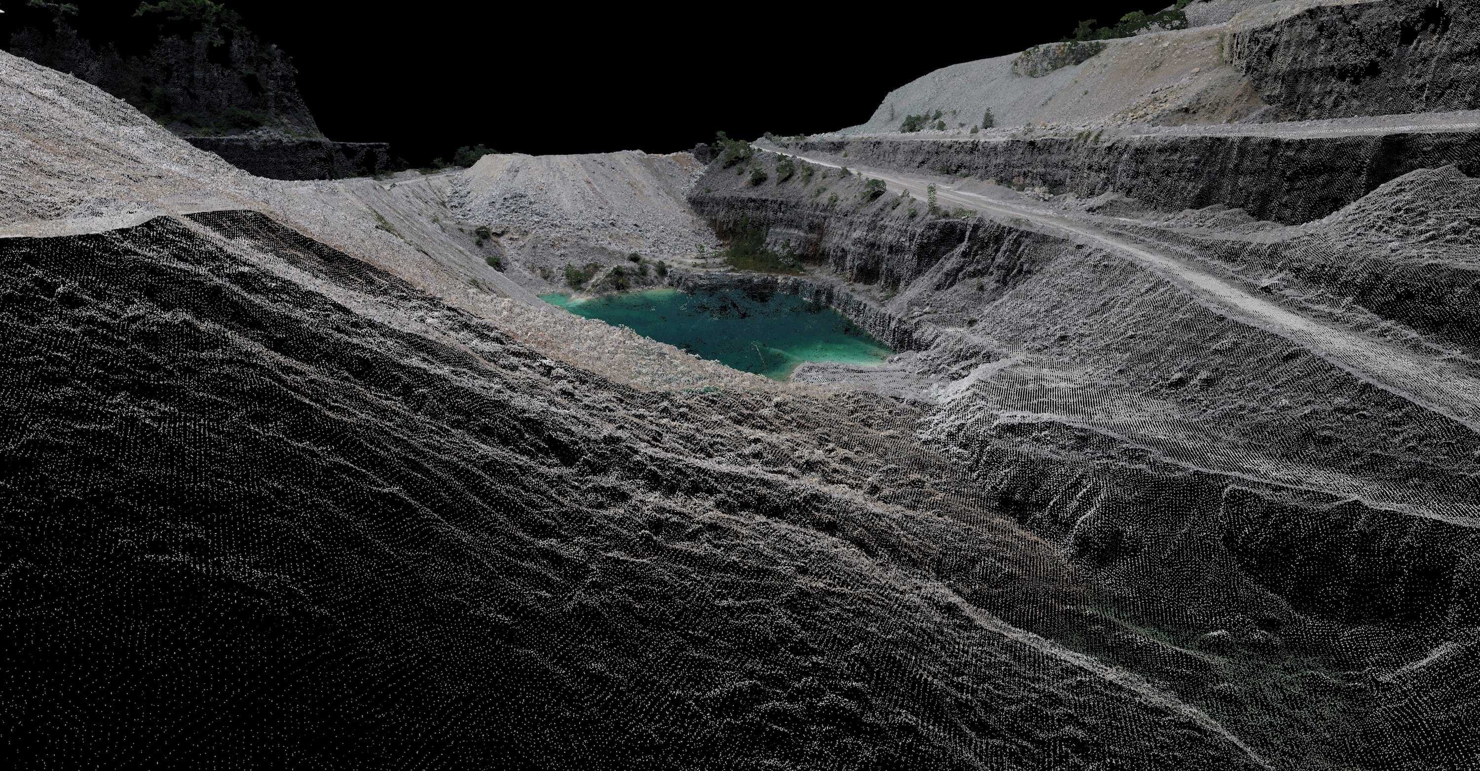
Leading the industry in stockpile measurement and inventory management for the aggregate mining industry for 30 years, serving 14 of the top 15 producers.

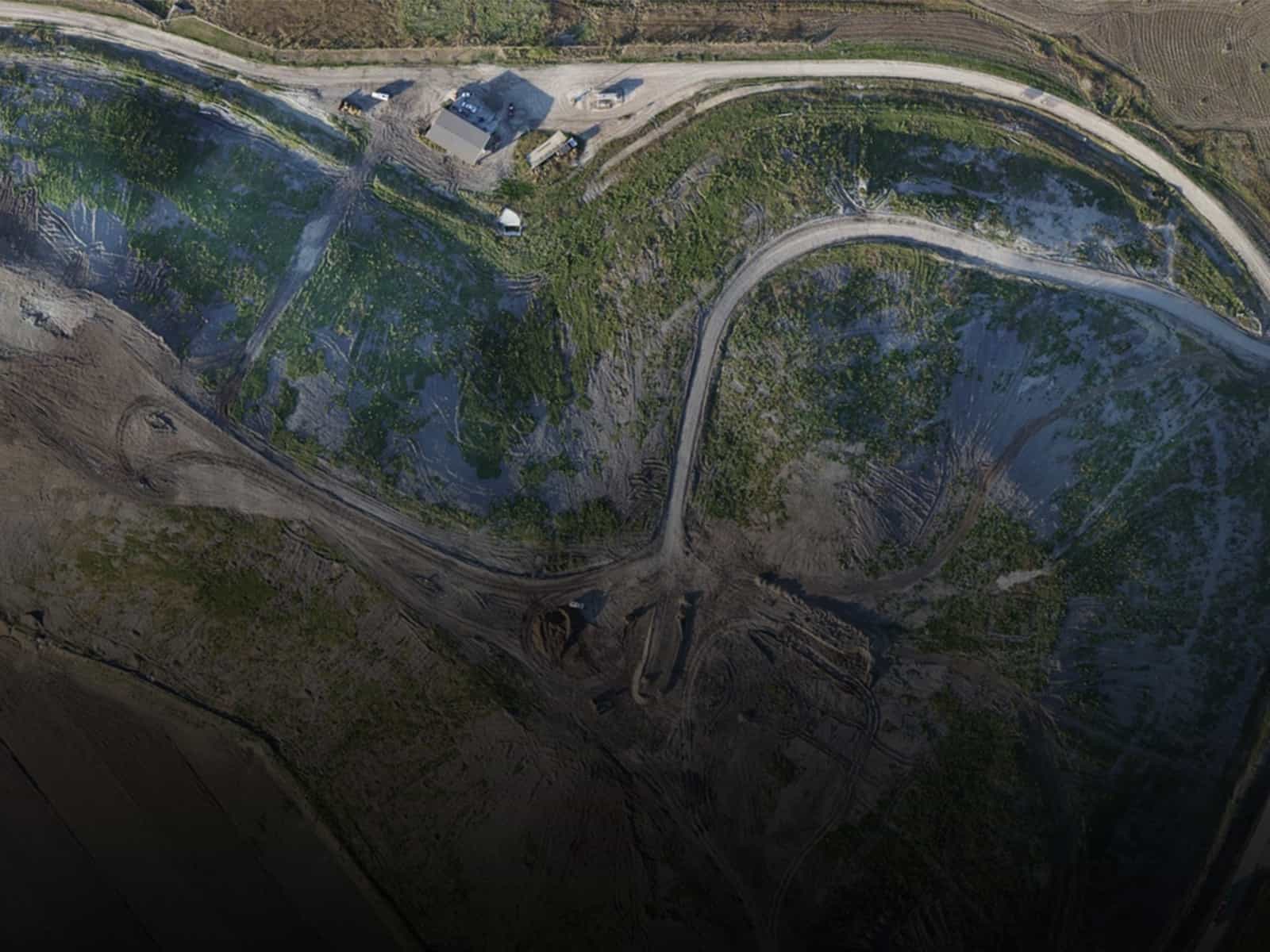
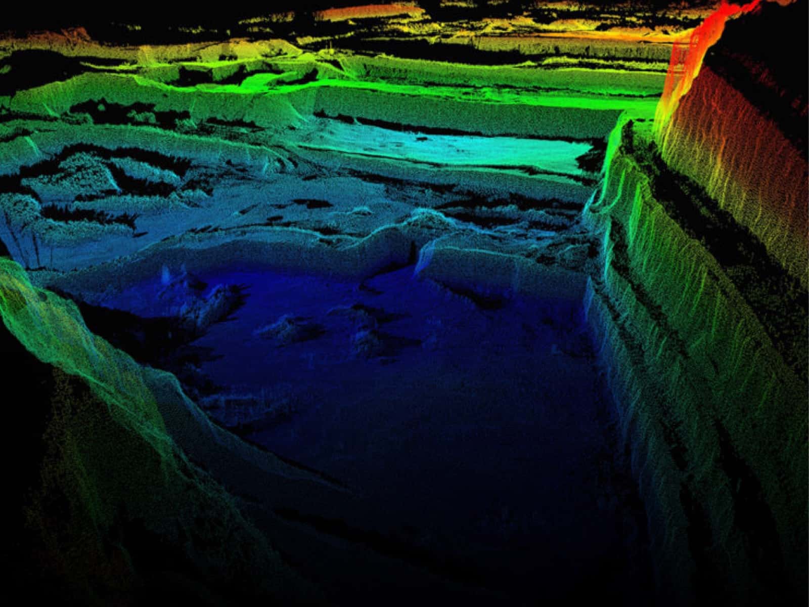
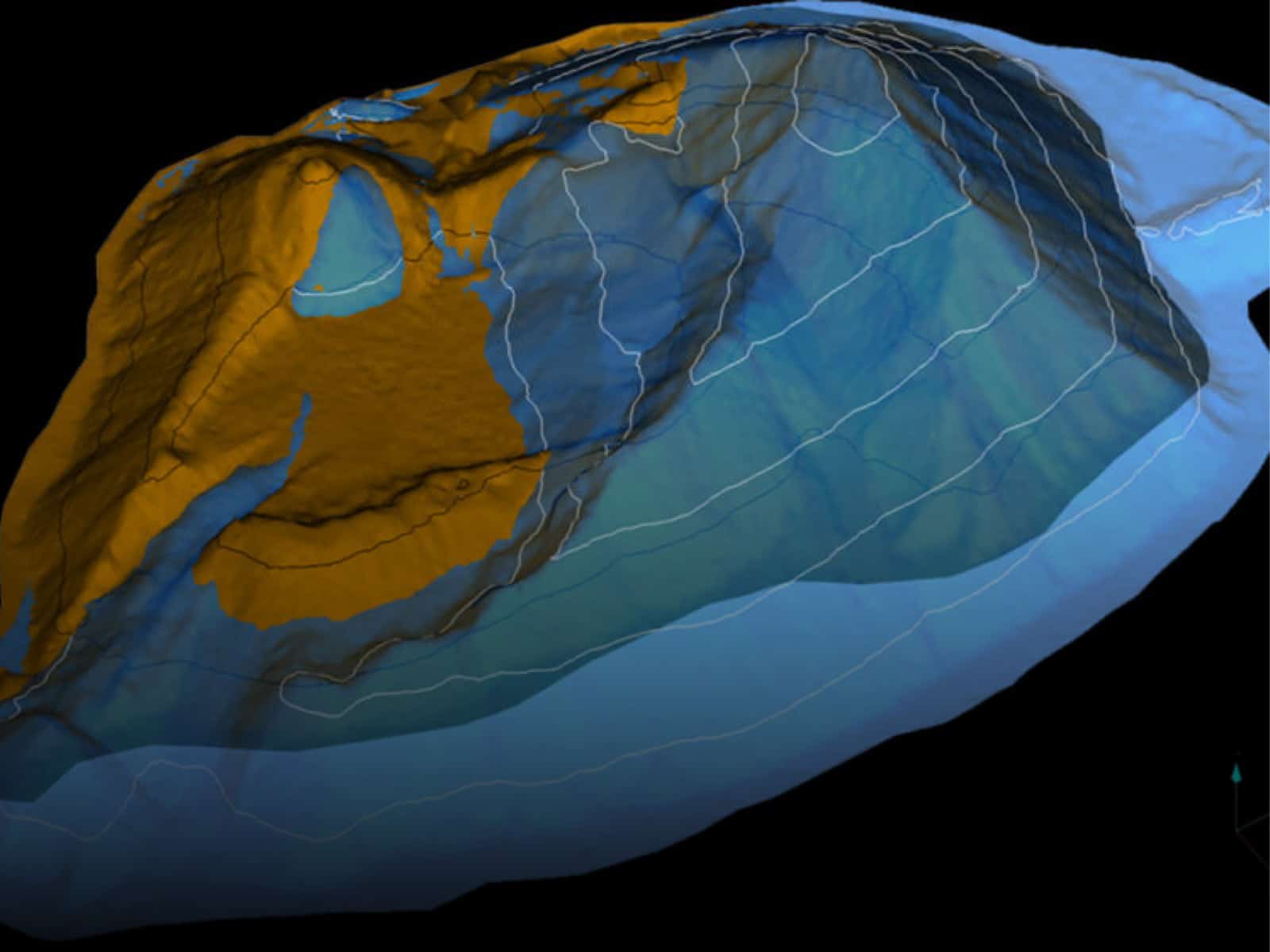
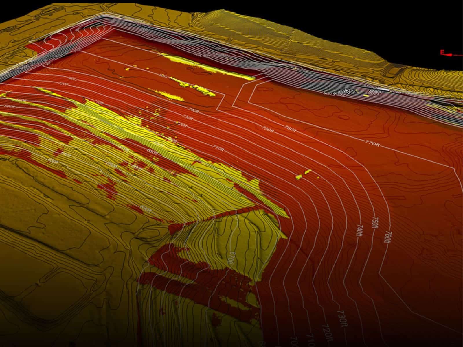
Landfill & Waste Management
Helping landfills maximize and manage their airspace and densities. Firmatek is the national provider of data collection and analysis for one of the largest solid waste companies in the United States.

Electric Utilities
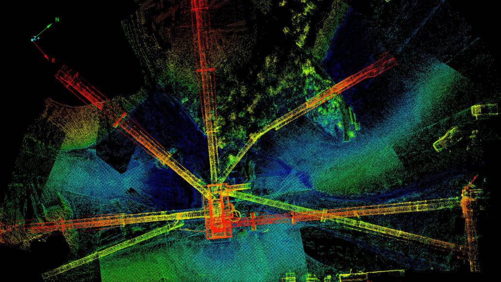
Meeting the needs of transmission and distribution line utilities. We use LiDAR and photogrammetry to collect data for right of way vegetation management, joint use pole audits, and comprehensive visual inspections.

Disaster Response
Collecting aerial imagery with real-time data processing capabilities provides a comprehensive understanding of the conditions at hand in a safe, timely manner. Our team of experienced field technicians is fully equipped for continuous operations and rapid deployment.

Construction
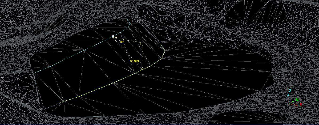
The use of LiDAR and aerial data imagery on construction sites is an innovative approach that can identify better work practices, highlight safety issues and provide a new perspective to owners, contractors and investors.

Contact Us
Get the most out of aerial data and transform your site data into powerful insights.
Deliverables
Experts in data capture and analysis, we transform data into actionable insights through customized deliverables.