How Gen Z Interns Solve Problems at Firmatek
By Andrew Maximow, Chief Drone Officer We demonstrate the values that are important to us on a daily basis. Our
...
Did You Know Series: Why Firmatek is Hardware and Software Agnostic
By Lauren Elmore, Chief Executive Officer Did you know that Firmatek is hardware and software agnostic? We believe in...
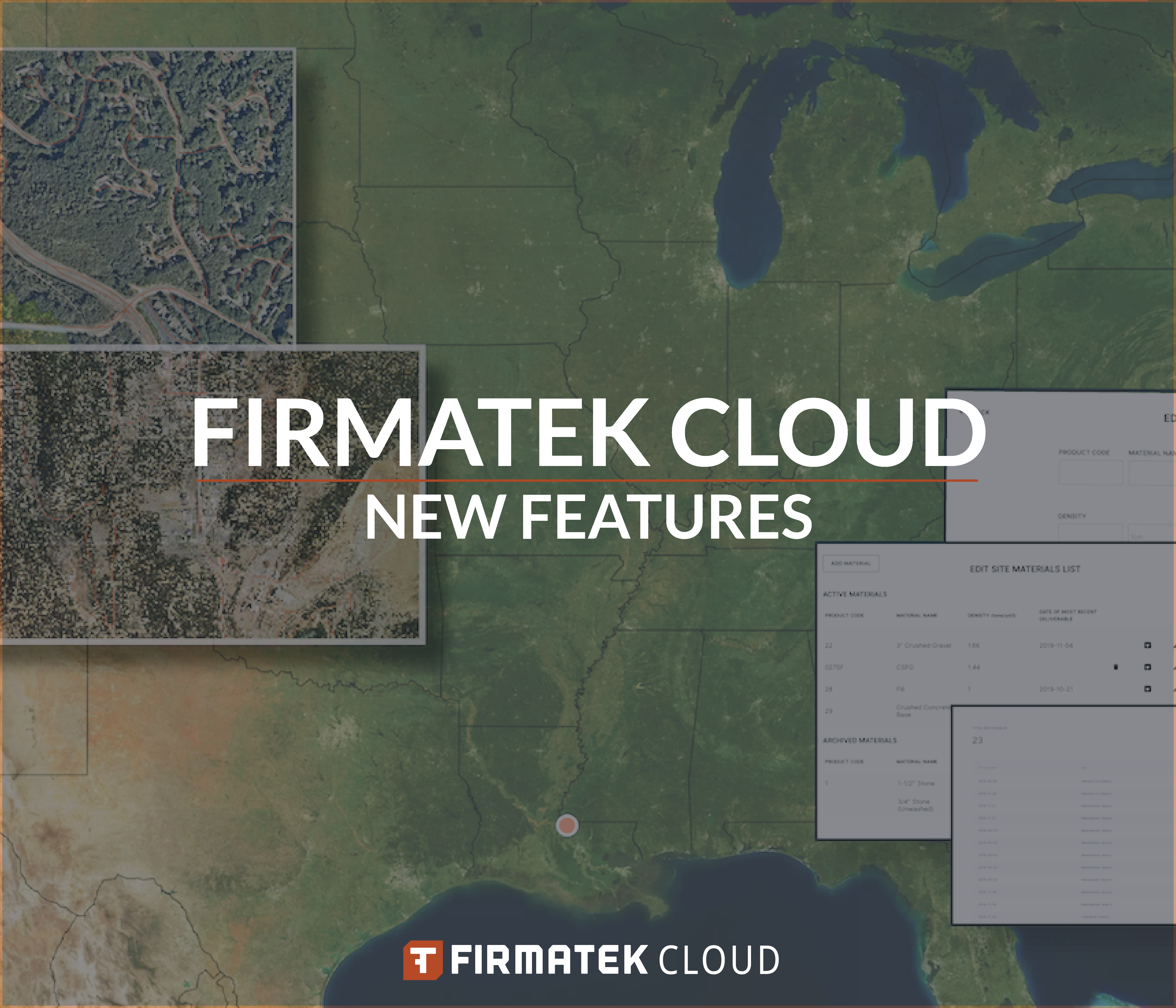
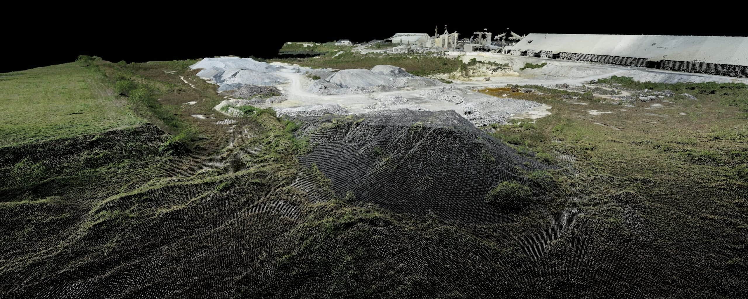
Firmatek Launches 7 New Features on Firmatek Cloud
Data innovation is a big deal at Firmatek. You might have seen our previous blogs, where we’ve guaranteed to se...
Firmatek is Your Partner in Big Data Innovation
By Agha Zain, Vice President of Product and Software Development What is big data and why is it important? Simply
...
Learn More About the Industries We Serve! Introducing the “Did You Know” Firmatek Blog Series
By Lauren Elmore, Chief Executive Officer Did you know that Firmatek is more than a stockpile measurement company? Wh...
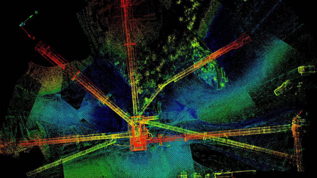
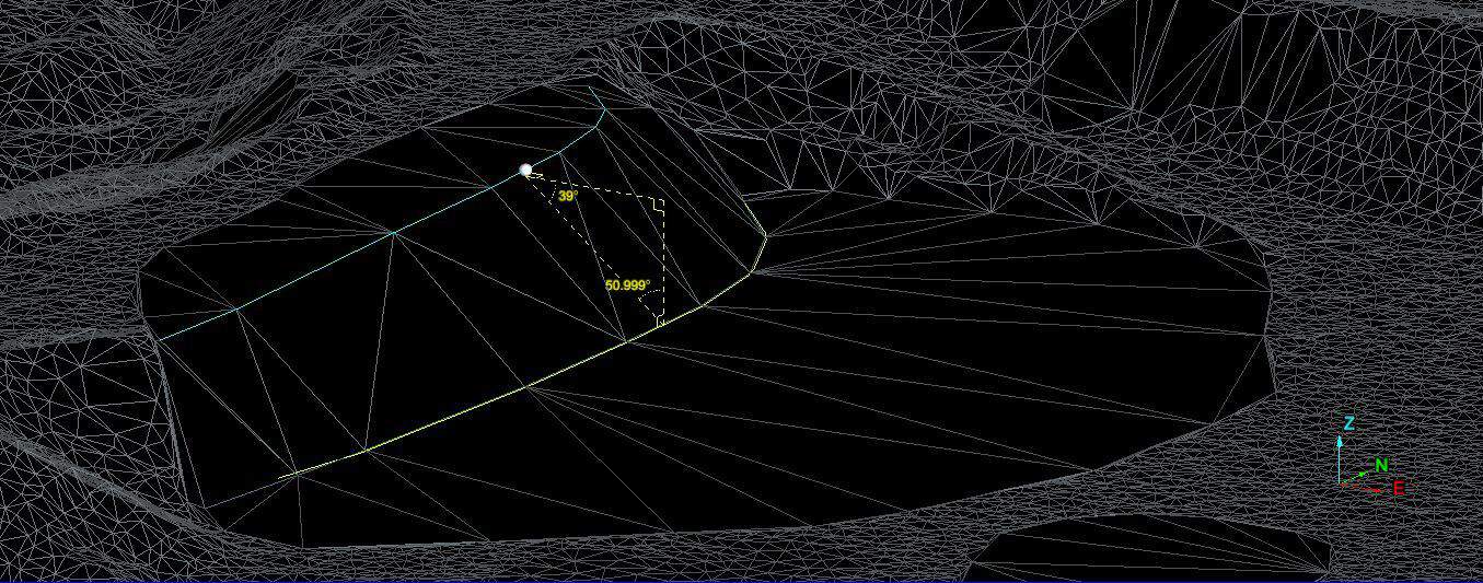
Scholarly Article: Multi-Sensor Assessment of the Effects of Varying Processing Parameters on UAS Product Accuracy and Quality
Abstract: There is a growing demand for the collection of ultra-high spatial resolution imagery using unmanned aerial...
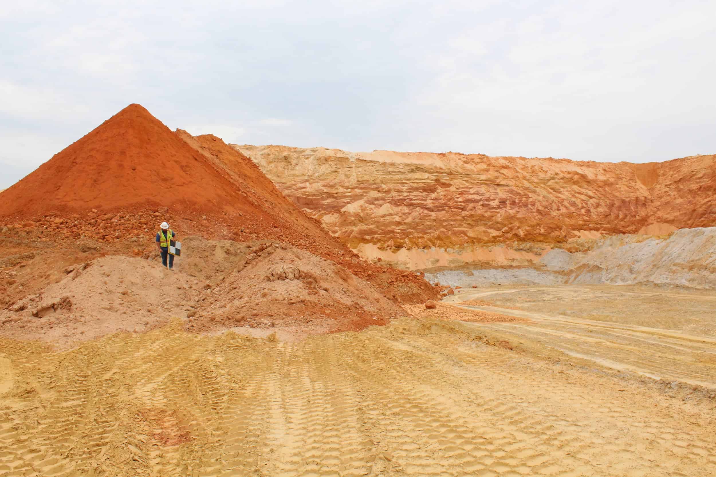
Stockpile Analysis and the Importance of a Good Base
By Dillon Tiller, Geospatial Data Processor The stockpile’s base is a commonly overlooked component when conducting...
Blog Series: What’s Your Why, Joshua Wilson
By Joshua Wilson, Geospatial Field Technician Team Leader When I was recently asked the question, “what’s your wh...
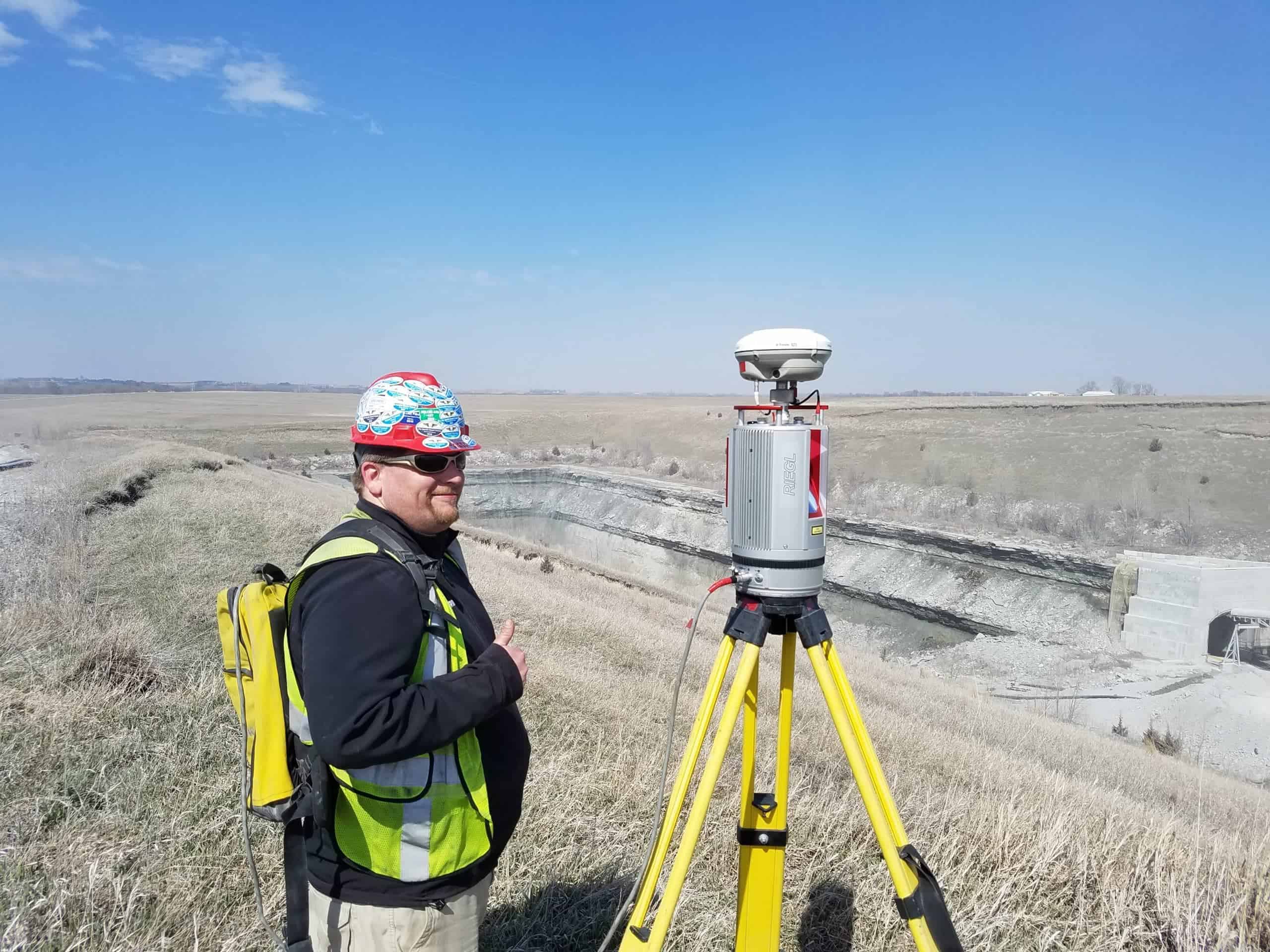
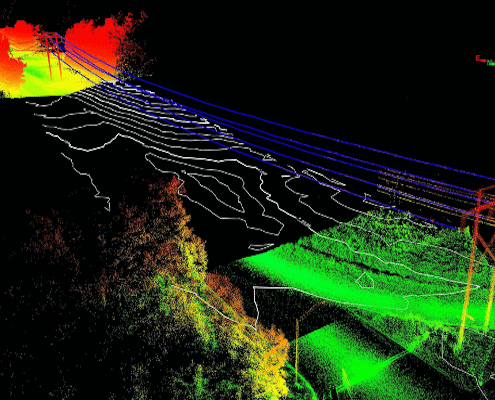
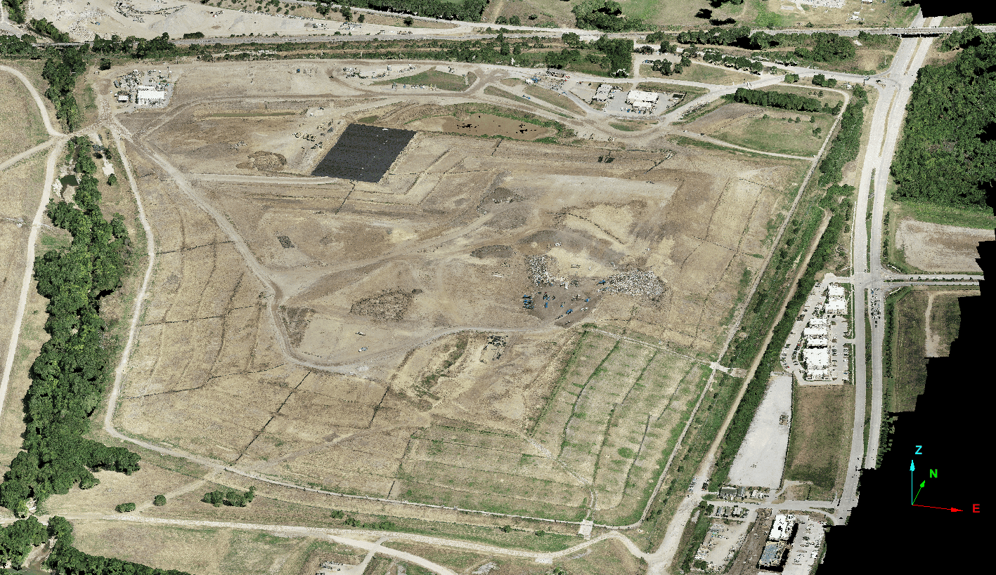
Firmatek’s Trusted Waste Monitoring Solutions
By Seaver Hall, Project Engineer Firmatek has been a trusted service provider in the 3D mapping industry for several ...
Firmatek’s Digital Data Mapping Technology Outperforms Traditional Methods of Utility Inspections
By Kate Steger, Business Development Representative Over the past year and a half, Firmatek has used our data mapping...
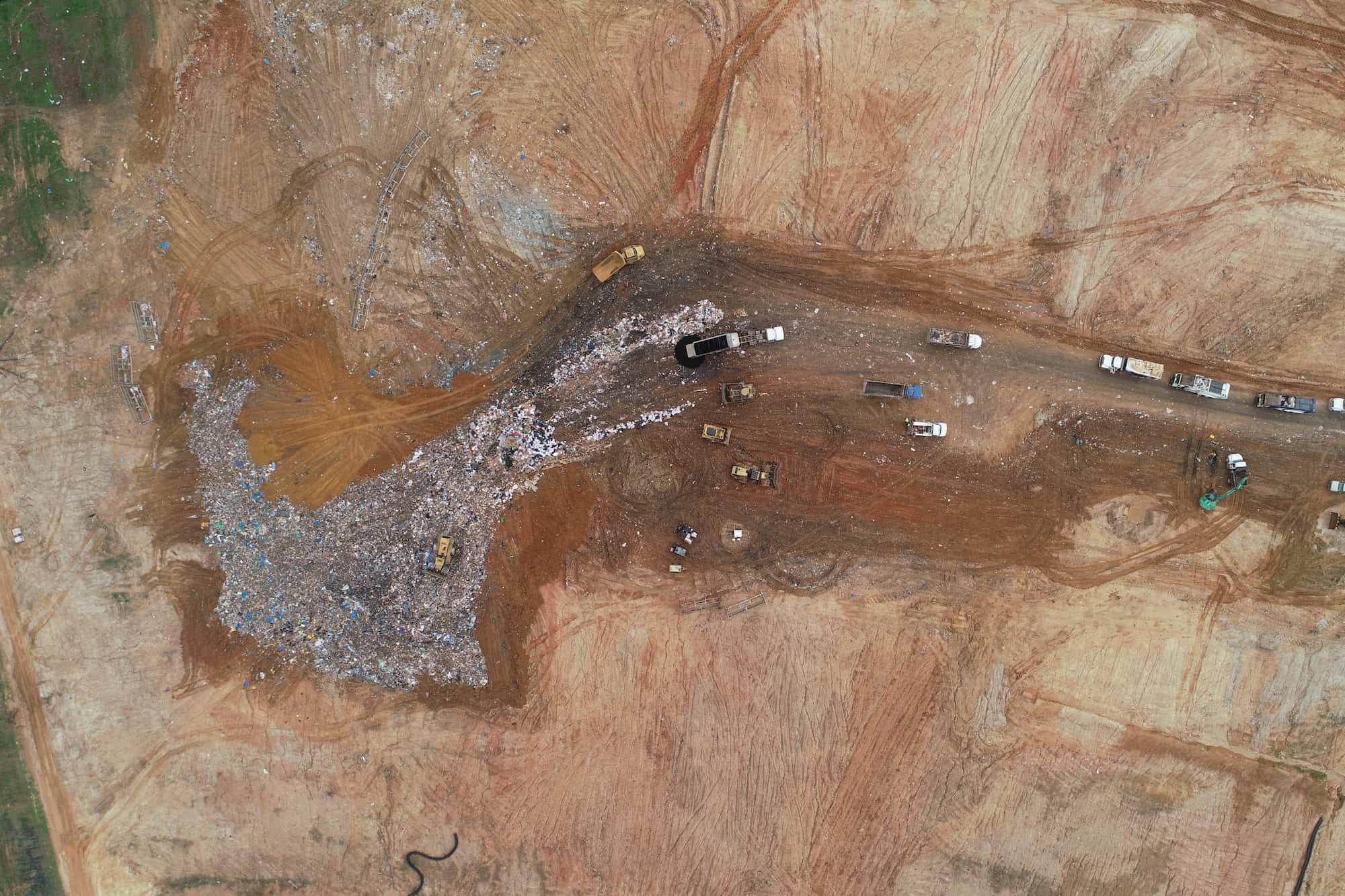
Why You Should Manage Landfill Stockpiles with Modern Technology
By Caleb Cass PE, Director of Engineering When high accuracy stockpile measurements are not performed regularly, you ...
Blog Series: What’s Your Why, Justin Real
By Justin Real, Geospatial Field Technician Picture this, clouds rolling over the Spanish Peak mountain range with a ...