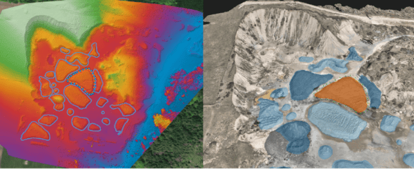
Pix4D is partnering with Firmatek, a U.S.-based geospatial solutions company whose DIY Mapping platform enables companies across mining, aggregates, and construction to turn drone-captured imagery into precise volumetric measurements, 3D models, and progression maps.
Through the Kespry Cloud Platform customers fly their own drones, upload images, and enable data-driven decisions through intuitive visualization and reporting supported by trusted advisors who eliminate the need for in-house photogrammetry expertise.
The solution
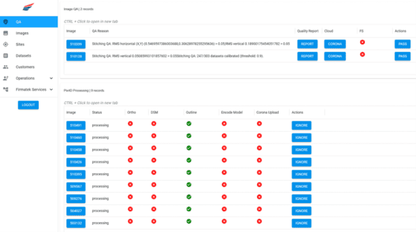
At the end of 2025, Firmatek transitioned from Pix4D’s Cloud API to the PIX4Dengine SDK, embedding photogrammetry directly into their production pipeline. Because all data is processed within Firmatek’s environment, customer data never leaves their infrastructure—improving security, reducing transfer overhead, and allowing full control over how and where data is handled. Firmatek can now scale compute resources on demand, stitch multiple jobs in parallel, and automatically assign native and non-native camera templates that improve output quality—all while their automated QA system catches failures early to avoid unnecessary cost and delay.
The results
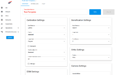
The results speak for themselves: completed products flow seamlessly into post-processing and tiling workflows with no API handoff, a custom GUI lets staff adjust parameters on the fly, and Firmatek has cut photogrammetry costs by more than 40% while delivering faster turnaround and fewer processing errors to customers.
Looking ahead, the SDK will also allow for the platform to support automated GCP (Ground Control Point) tagging, further improving stitch accuracy and product quality. Additionally, Firmatek’s service pilots can upload raw imagery directly to the Kespry Cloud. Leveraging cloud innovation to eliminate local stitching, Firmatek responsibly streamlines operations and accelerates delivery, passing higher quality results.
About Firmatek
Firmatek is a geospatial data company dedicated to the democratization of actionable insights. Their DIY Mapping platform combines industry-leading technology with dedicated expertise to provide companies in mining, aggregates, and construction with precise volumetric data, 3D models, and progression mapping through the Kespry Cloud Platform. By simplifying the complexity of data capture, processing, and analysis, Firmatek empowers customers to make confident, data-driven decisions across their operations.
About Pix4D
Pix4D is the market leader in photogrammetry software technology. Their products enable the digitization of reality and measurement of images taken from planes, drones, phones, or other cameras. PIX4Dengine is a fully customizable photogrammetry reconstruction engine, built for automation and integration into any enterprise system—allowing companies to build the photogrammetry they need, streamline data management, and automate at scale.
Interested in the technology behind these results? Check out Pix4D’s feature on the partnership and learn how Firmatek is leveraging PIX4Dengine SDK to deliver faster, more secure, and more scalable drone data processing.