Kespry Cloud
Improve operational decision-making with the complete drone analytics solution that measures, analyzes, and visualizes data and can be accessed from anywhere.
Login to Kespry CloudKespry Cloud Aerial Intelligence Platform
Breaking down barriers to confident decision making
We’re trusted by our customers because we provide a cutting-edge drone data and analytics solution for market leaders in mining and aggregates, solid waste, landfill & waste management, and pulp & paper. The Kespry Cloud platform is easy to deploy in the field, with the ability to accurately measure topography, perform volumetric calculation, and run analytics to help manage operations more efficiently. Kespry Cloud gives our customers the insights needed to make better business decisions.

Access data and analytics from anywhere
Our ability to gather a high quantity of quality data at a national level enables our partners to proactively manage their businesses from anywhere. Through Kespry Cloud, data analysis is available faster, made accessible to more people within the organization, and intuitively presented to ensure actionability. We remove the guesswork and create certainty when it comes to making important decisions that protect your bottom line.
Make Your Business More Profitable
Strengthen Data Accuracy & Reliability
Reduce costs and strengthen your confidence with highly accurate data and the ability to quickly and easily visualize and analyze your data.
Increase Frequency & Consumption
To make intelligent business decisions, companies need more than just accurate data. They need access to timely, consistent data in order to identify trends and observe larger patterns. Because Kespry Cloud is quick and easy to use, it encourages more frequent and regular usage.
Improve Worker Safety
Protect employees by using aerial data capture and automated systems that keep them out of harm’s way.

Use Cases

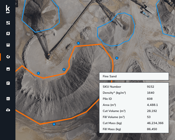
Inventory
Management
Customers use Kespry to autonomously measure stockpile volumes and manage inventory across all their sites. All their GIS data is stored in one central cloud application. The data is accessible by the entire team for analysis and can also easily be used in their operational systems.

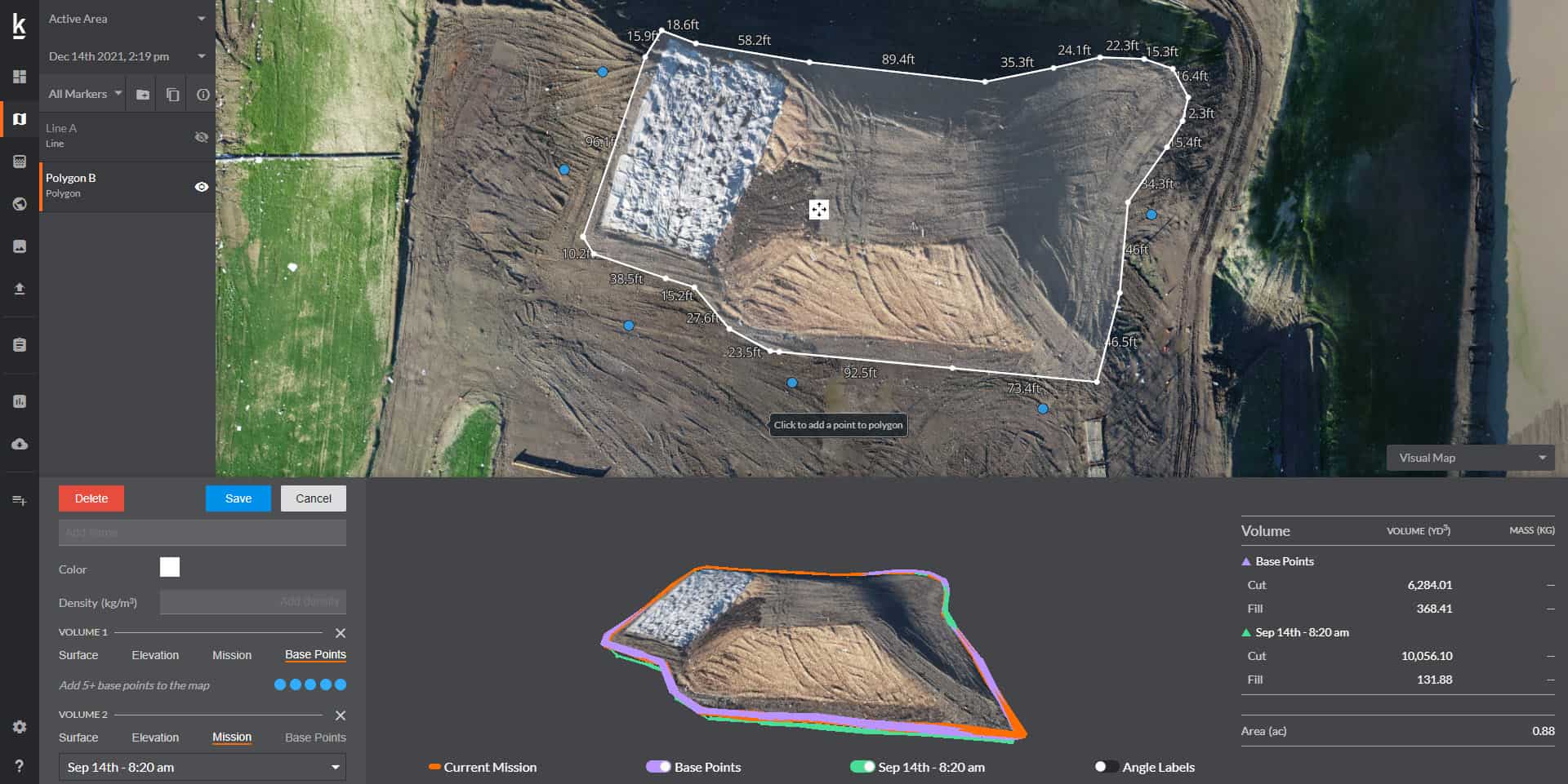
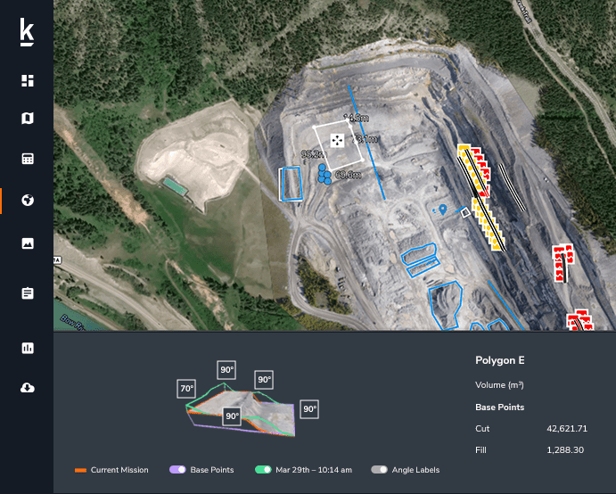
Mine Planning & Earthworks
Use Kespry to calculate earthwork quantities and update mine plans. Get an on-demand visual history of site activity. Know how much dirt was moved, calculate cut-and-fill volumes, and track progress.

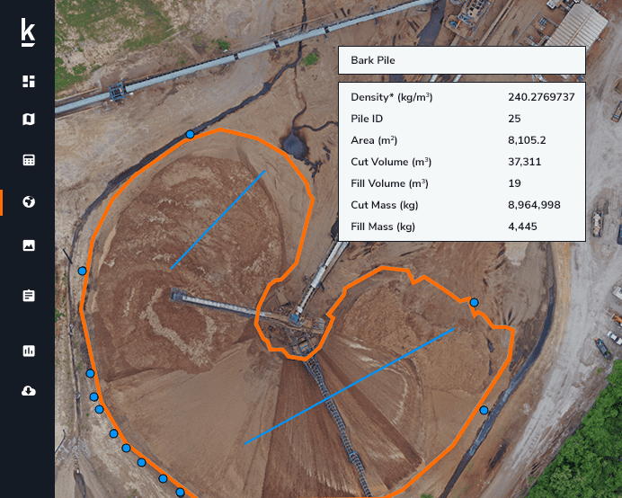
Landfill Operations Management
Track key metrics and aggregate information across your sites to get a full picture of operations across an area. With Kespry, the information you need to improve operational decision-making is at your fingertips.
Industries
Kespry Cloud empowers customers in industries we serve with the tools they need to improve operational decision-making.